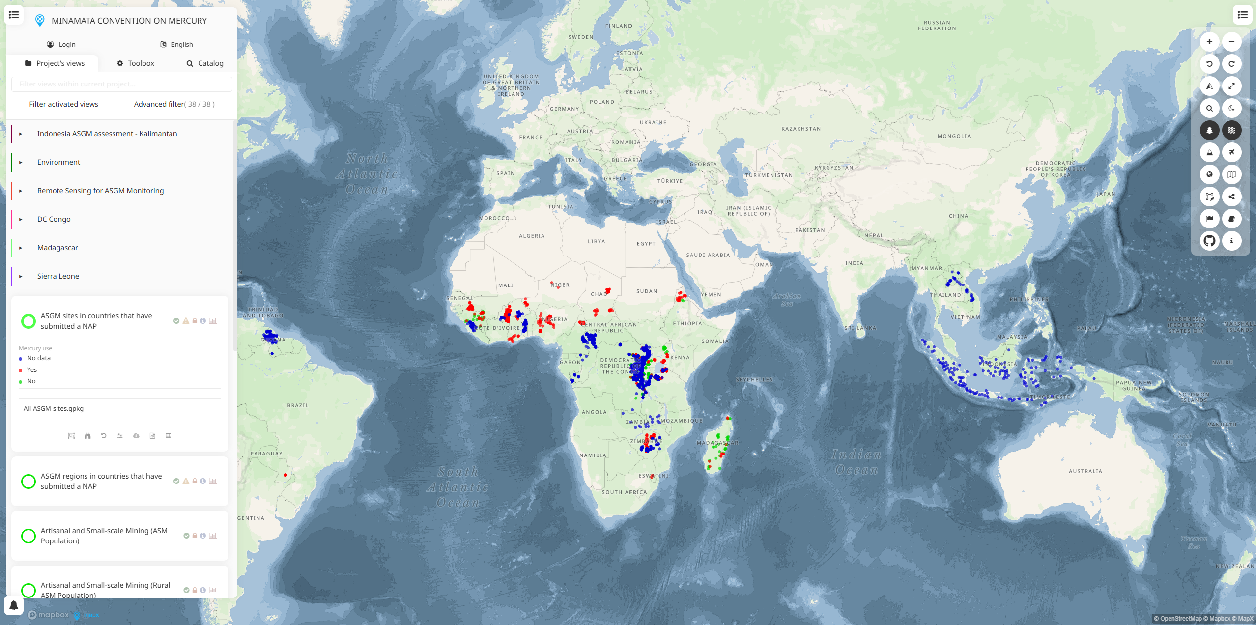
The Minamata Convention Data Platform is an interactive mapping tool that tracks artisanal and small-scale gold mining (ASGM) activities globally to support mercury pollution reduction efforts under the Minamata Convention on Mercury. This platform helps countries identify ASGM hotspots, assess mercury use patterns, and develop targeted strategies for reducing mercury emissions from gold mining operations.
The platform provides critical data for implementing the Minamata Convention's requirements for reducing and eliminating mercury use in ASGM, which is one of the largest sources of global mercury emissions to the environment.
Key Features
- ASGM Site Mapping: Interactive maps showing locations of artisanal and small-scale gold mining operations worldwide
- Mercury Use Assessment: Data on mercury consumption patterns and emissions from mining activities
- Country-Level Analysis: Tools for analyzing ASGM activities within specific national boundaries
- Temporal Tracking: Historical data to monitor changes in mining patterns over time
- Multi-Language Support: Available in multiple languages to support global implementation
- Data Visualization: Charts, graphs, and maps for presenting mercury monitoring data
- Export Capabilities: Download data for further analysis and reporting
Applications
- National Action Plans: Support development of ASGM National Action Plans required under the Minamata Convention
- Policy Development: Inform mercury reduction policies and regulations at national and regional levels
- Environmental Monitoring: Track mercury pollution sources and assess environmental impacts
- Health Risk Assessment: Identify communities at risk from mercury exposure from ASGM activities
- International Cooperation: Share data and coordinate mercury reduction efforts across borders
- Research and Analysis: Support scientific studies on mercury emissions and environmental fate
- Compliance Monitoring: Track progress toward mercury reduction goals under international agreements
Data Sources
- Satellite imagery analysis for ASGM site identification
- Field surveys and ground-truth data collection
- Government reports and official mining statistics
- Research studies on mercury use in ASGM operations
- Community-based monitoring programs
- Environmental sampling data
Use Cases
- Environmental Agencies: Monitor mercury emissions and develop reduction strategies
- International Organizations: Track global progress on mercury reduction commitments
- Mining Sector: Assess mercury use patterns and identify alternatives for ASGM operations
- Research Institutions: Study mercury pollution sources and environmental impacts
- NGOs and Communities: Monitor local mining activities and advocate for cleaner practices
- Development Organizations: Design programs to support mercury-free mining techniques
- Policy development and regulatory compliance
- Educational and training applications
Minamata Convention Data Platform provides essential capabilities for understanding and addressing climate and nature-related challenges in today's changing world.