Hochwassergefahren- und Hochwasserrisikokarten in Deutschland is Germany's official flood hazard and risk mapping system coordinated by the Federal Institute of Hydrology (BfG).
This comprehensive flood mapping system provides detailed hazard and risk assessments for rivers and coastal areas across Germany, supporting flood risk management and EU Floods Directive implementation.
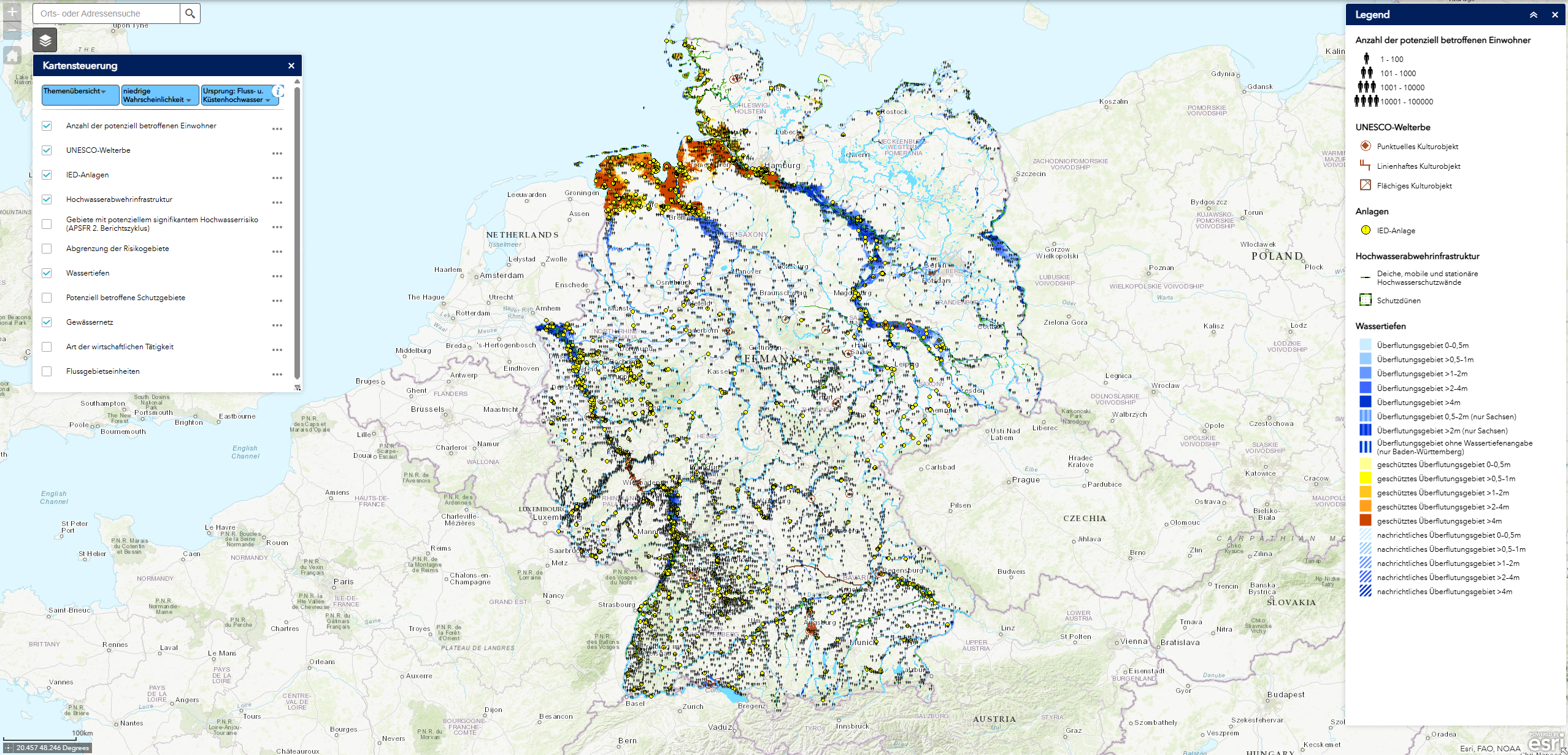
Key Features
- Nationwide flood mapping covering all significant rivers and coastal areas in Germany
- Multiple return periods including 10-year, 100-year, and extreme flood scenarios
- Hazard and risk differentiation showing both flood extent/depth and potential consequences
- EU Floods Directive compliance meeting European flood risk assessment requirements
- Regular updates incorporating new data and improved modeling techniques
- Public accessibility through web portals and downloadable data formats
Mapping Components
- Flood hazard maps showing water depths, flow velocities, and inundation extents
- Flood risk maps displaying potential impacts on population, economy, and environment
- Return period scenarios covering frequent (10-year), medium (100-year), and extreme events
- Coastal flood mapping for North Sea and Baltic Sea coastal areas
- Urban flood assessments for cities and densely populated areas
- Critical infrastructure showing risks to hospitals, schools, and essential services
Data Sources and Methods
- Hydrological modeling using advanced 2D flood simulation techniques
- Digital elevation models providing high-resolution topographic data
- Historical flood records validating models against observed flood events
- Climate projections incorporating future precipitation and sea level changes
- Land use data showing current development patterns and exposure
- Infrastructure databases mapping critical facilities and population centers
Applications
- Flood risk management for water authorities and emergency services
- Urban planning incorporating flood risks into development decisions
- Insurance industry risk assessment and premium calculation
- Emergency preparedness for evacuation planning and response coordination
- Infrastructure planning for flood-resilient design and placement
- Climate adaptation integrating flood projections into long-term planning
Use Cases
- Water management agencies develop flood protection strategies and infrastructure investments
- Municipal planners integrate flood risks into zoning and building regulations
- Emergency services plan evacuation routes and emergency response procedures
- Insurance companies assess flood risks for property coverage and pricing
- Infrastructure operators evaluate flood vulnerability for critical facilities and transportation networks
- Environmental impact evaluation for projects
- Research and analysis for academic and scientific purposes
- Policy development and regulatory compliance
- Educational and training applications
Hochwassergefahren- und Hochwasserrisikokarten in Deutschland provides essential capabilities for understanding and addressing climate and nature-related challenges in today's changing world.