Data Sources/OpenTopography

OpenTopography

OpenTopography provides free, high-resolution elevation and LiDAR data for GIS, remote sensing, and environmental analysis.

Infrastructure Development

Plan, monitor, and manage roads, utilities, and buildings using topographic, cadastral, and engineering data.

Disaster Response

Support rapid disaster assessment, emergency management, and recovery efforts with real-time and historical hazard data.

Renewable Energy

Identify optimal locations for solar, wind, and other renewable energy installations using terrain and climate data.

OpenTopography

OpenTopography solves a practical problem with high-resolution elevation data: LiDAR point clouds are enormous, require specialized software to process, and are scattered across dozens of different agency and institutional repositories.

OpenTopography centralizes access to these datasets and adds cloud-based processing on top — so you can generate custom DEMs, hillshade maps, slope and aspect products, and hydrological derivatives from raw point clouds without downloading gigabytes of data and running processing pipelines locally. Funded by NSF and operated in partnership with USGS, it's the largest community-accessible portal for topographic data at resolutions from sub-meter LiDAR to global 30-meter satellite DEMs.

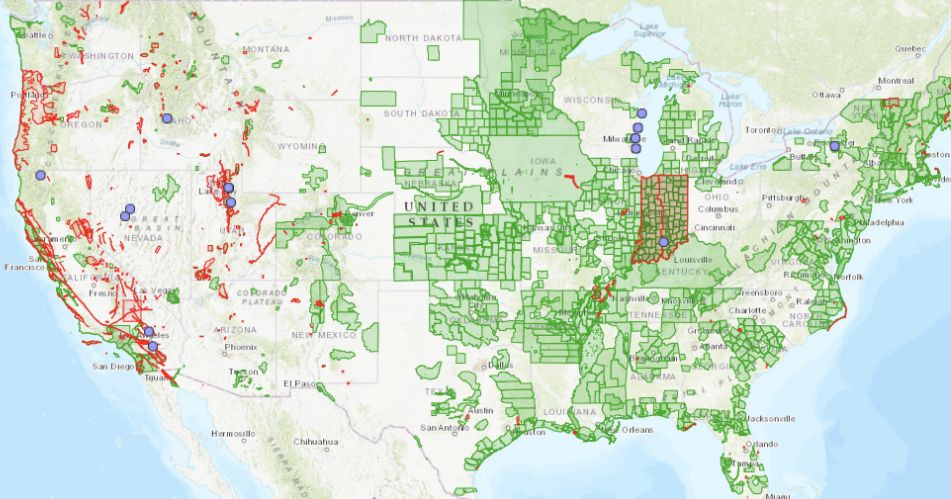
The platform matters most for projects that need elevation detail beyond what global DEMs provide. SRTM and Copernicus DEM give you 30-meter or 90-meter resolution worldwide, which is sufficient for regional terrain analysis — but infrastructure engineering, flood modeling at local scale, landslide assessment, forestry canopy studies, and archaeological surveys often need the sub-meter precision that only LiDAR delivers.

OpenTopography makes that data accessible without commissioning a survey or purchasing from commercial providers. Coverage is strongest in the United States (particularly through the USGS 3DEP program), with growing collections from Europe, New Zealand, and other regions contributed by research institutions. For areas where LiDAR hasn't been flown, OpenTopography also provides convenient access to the global satellite DEMs as a fallback.

How to use OpenTopography in Atlas?

Frequently Asked Questions

A web-based portal providing free access to high-resolution topographic data including LiDAR point clouds, DEMs, and photogrammetric datasets from research and government sources worldwide.

Airborne LiDAR, terrestrial LiDAR, structure-from-motion photogrammetry, satellite-derived DEMs (SRTM, ALOS), and bathymetric datasets.

Yes. All data access is free. Registration is required for on-demand processing of LiDAR point clouds into custom DEM products.

Varies by dataset. LiDAR data typically ranges from 0.5 to 2 meters. Global datasets like SRTM are at 30 meters. Some photogrammetric datasets reach centimeter resolution.

GeoTIFF for raster DEMs, LAS/LAZ for LiDAR point clouds. The platform also offers on-demand processing to generate hillshade, slope, and aspect products.

Details

CoverageGlobal
Layer TypeRaster
Update FrequencyVaries by dataset
Categories
Elevation
Visit sourceUse data in Atlas

Discover more data sources

Our World in Data

Our World in Data is a free online research publication providing data and visualizations on global development, health, energy, climate, and inequality. It provides downloadable datasets on hundreds of indicators with consistent historical coverage, widely used for research, journalism, and policy analysis.

Demographics, Health, Environmental, Historical

Consumer Data Research Centre

Explore the Consumer Data Research Centre's geographic datasets on UK consumer behavior, housing, and retail.

Demographic

Copernicus Open Access Hub

Copernicus Open Access Hub provides free, high-resolution satellite imagery from the Sentinel satellite program.

Remote Sensing

Office for National Statistics

The Office for National Statistics (ONS) is the UK's go-to source for census, population, and geographic data.

Demographic

World Resources Institute

The World Resources Institute (WRI) provides free, high-quality environmental data for GIS, climate research, and sustainability projects.

Climate

Global Administrative Areas

Global Administrative Areas (GADM) provides free, high-resolution administrative boundary data for every country. With detailed subdivisions, multi-level GIS support, and global coverage, it's a must-have resource for urban planning, policy research, and geospatial analysis.

Mapping

National Geospatial-Intelligence Agency

The National Geospatial-Intelligence Agency (NGA) provides free, high-quality geospatial data, including elevation models, topographic maps, and navigation resources.

Mapping

European Space Agency

ESA Earth Observation Data provides free, high-resolution satellite imagery from the Sentinel missions, covering land, ocean, and atmosphere. With data for climate monitoring, disaster response, and GIS applications, it's a top resource for researchers and professionals.

Remote Sensing