MODIS

MODIS provides free, global satellite data for climate monitoring, land cover analysis, and disaster response.

Environmental Monitoring

Track environmental changes including deforestation, pollution levels, and ecosystem health using Earth observation data.

Agriculture & Land Use

Monitor crop health, soil conditions, and land use changes for precision agriculture and sustainable land management.

Climate Analysis

Analyze climate patterns, weather trends, and atmospheric conditions for research, risk assessment, and long-term planning.

MODIS

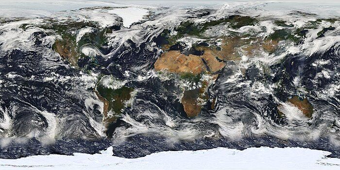
MODIS (Moderate Resolution Imaging Spectroradiometer) occupies a unique niche in the satellite ecosystem: it trades spatial resolution for temporal frequency and thematic breadth. While Sentinel-2 and Landsat provide sharper imagery, MODIS captures the entire Earth every 1–2 days across 36 spectral bands — and has been doing so continuously since 2000.

That combination of daily global coverage and a 25-year archive makes MODIS the go-to source for broad-scale monitoring where detecting change over time matters more than resolving fine spatial detail: seasonal vegetation cycles, continental fire patterns, snow extent dynamics, and ocean productivity trends all rely on MODIS data as their observational backbone.

What makes MODIS particularly accessible is that NASA distributes it as preprocessed, analysis-ready products rather than just raw imagery. Vegetation indices, land surface temperature, fire detections, snow cover, ocean color, and atmospheric measurements are all available as standardized composites that can be used directly without the calibration and atmospheric correction steps that raw satellite data typically requires.

This lowers the barrier to entry significantly — a vegetation time-series analysis that would require substantial preprocessing with Landsat imagery can start immediately with MODIS NDVI composites. For GIS workflows that need a long, consistent baseline of environmental observations at continental or global scale, MODIS remains the most complete record available.

Frequently Asked Questions

The Moderate Resolution Imaging Spectroradiometer is a sensor aboard NASA's Terra and Aqua satellites, providing daily global coverage of land, ocean, and atmosphere since 2000.

250m, 500m, and 1km depending on the spectral band. MODIS has 36 spectral bands covering visible, near-infrared, and thermal wavelengths.

Yes. All MODIS products are freely available through NASA Earthdata, USGS LP DAAC, and Google Earth Engine.

Vegetation indices (NDVI, EVI), land surface temperature, snow cover, fire detections (active fire and burned area), ocean color, cloud properties, and aerosol measurements — all as preprocessed, analysis-ready products.

MODIS offers daily global coverage at moderate resolution (250m-1km), ideal for broad-scale monitoring. Landsat (30m, 16-day) and Sentinel-2 (10m, 5-day) provide much higher spatial detail but revisit less frequently.

Details

CoverageGlobal
Layer TypeRaster
Update FrequencyDaily
Categories
Remote Sensing
Visit sourceUse data in Atlas

Discover more data sources

GEBCO

Global ocean bathymetry at 15 arc-second resolution from the General Bathymetric Chart of the Oceans.

Elevation

Global Flood Database

The Global Flood Database offers satellite-derived maps of 913 flood events from 2000 to 2018, detailing extent and duration.

Demographic

GBIF

Over 2.5 billion georeferenced species occurrence records from the world's largest open biodiversity platform.

Biodiversity

geoBoundaries

geoBoundaries provides free, open political boundary shapefiles for every country in the world. Download national and subnational borders in GIS formats for mapping, analysis, and policy projects.

Demographic

American Community Survey

The American Community Survey (ACS) provides detailed U.S. demographic and socioeconomic data ideal for GIS analysis.

Demographic

ACLED — Armed Conflict Location & Event Data

ACLED (Armed Conflict Location & Event Data Project) provides free real-time data on political violence, conflict events, and protests globally. Used by researchers, NGOs, governments, and journalists to track and analyze conflict patterns with precise location and date information.

Conflict, Humanitarian, Real-time

European Space Agency

ESA Earth Observation Data provides free, high-resolution satellite imagery from the Sentinel missions, covering land, ocean, and atmosphere. With data for climate monitoring, disaster response, and GIS applications, it's a top resource for researchers and professionals.

Remote Sensing

ERA5

Hourly global climate reanalysis data from 1940 to present at 31km resolution, produced by ECMWF.

Climate