Local Sea Level Projections is a specialized platform by Climate Analytics that provides detailed sea level rise projections for coastal locations worldwide.
This tool offers tide gauge-specific and gridded sea level projections based on comprehensive climate models, helping users understand local coastal impacts under different global warming scenarios.
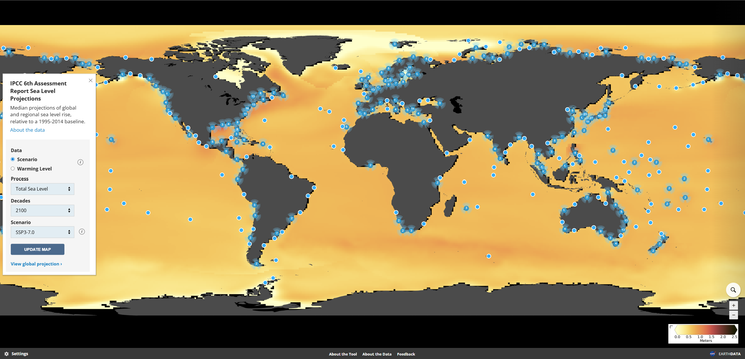
Key Features
- Location-specific projections for tide gauge stations and gridded locations globally
- Multiple warming scenarios including 2°C, 2.5°C, and 4°C+ pathways (RCP26, RCP45, RCP85)
- Uncertainty quantification with 66% and 90% confidence intervals
- Time series analysis from 2030 to 2200 with decadal projections
- Component breakdown showing contributions from ice sheets, glaciers, and ocean processes
- Expert judgment integration including revised Antarctic ice sheet contributions
Projection Components
- Antarctic ice sheet contributions based on IPCC AR5 and expert elicitation
- Greenland ice sheet dynamics and mass balance projections
- Glaciers and ice caps using improved IPCC AR5 methodologies
- Ocean thermal expansion from CMIP5 climate model simulations
- Ocean dynamics including regional circulation changes
- Land water storage accounting for population and land use changes
- Local processes including land subsidence and gravitational effects
Scenario Framework
- RCP2.6: Staying below 2°C warming with stabilization by 2100
- RCP4.5: Reaching approximately 2.5°C warming by century end
- RCP8.5: Exceeding 4°C warming with continued emissions growth
- Expert revisions: Including Bamber et al. (2019) Antarctic contributions
- Probabilistic approach: Uncertainty ranges from multiple model ensembles
Applications
- Coastal planning for sea level rise adaptation and infrastructure protection
- Climate risk assessment for coastal communities and assets
- Insurance industry modeling for coastal property and infrastructure risks
- Infrastructure design incorporating future sea level projections
- Policy development for coastal zone management and climate adaptation
- Research and education on regional sea level change patterns
Use Cases
- Coastal engineers design flood defenses and infrastructure with future sea levels
- Urban planners integrate sea level projections into long-term development plans
- Insurance companies assess coastal property risks under different climate scenarios
- Environmental managers plan coastal ecosystem conservation and restoration
- Researchers study regional patterns of sea level change and coastal impacts
- Environmental impact evaluation for projects
- Research and analysis for academic and scientific purposes
- Policy development and regulatory compliance
- Educational and training applications
Local Sea Level Projections provides essential capabilities for understanding and addressing climate and nature-related challenges in today's changing world.