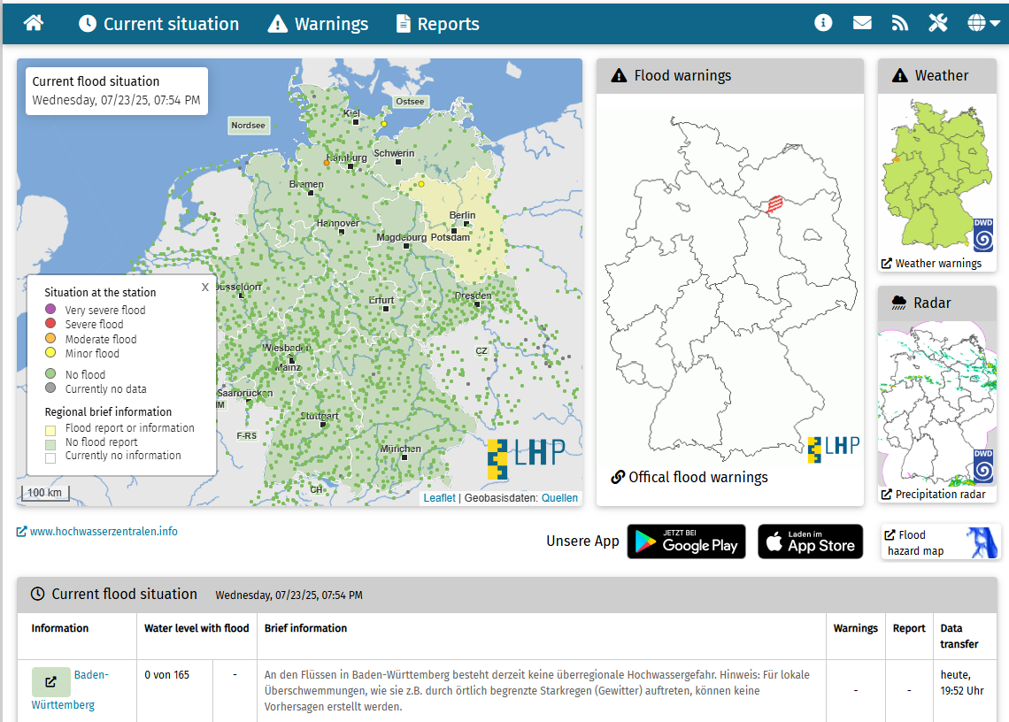
Länderübergreifendes Hochwasserportal is Germany's cross-state flood warning and information system operated by the federal flood forecasting centers.
This collaborative platform provides real-time flood monitoring, early warning systems, and comprehensive flood risk information across all German states, enabling coordinated flood management and emergency response.
Key Features
- Real-time flood monitoring from gauge stations across all German river systems
- Early warning systems with automated alerts for rising water levels
- Cross-state coordination enabling unified flood management across state boundaries
- Historical flood data for long-term trend analysis and risk assessment
- Interactive mapping showing current water levels and flood forecasts
- Multi-language support including English for international coordination
Monitoring Network
- Federal flood centers coordinating information from all 16 German states
- Gauge station network providing continuous water level and flow measurements
- Weather integration combining precipitation forecasts with hydrological models
- River system coverage including Rhine, Elbe, Danube, Weser, and regional rivers
- Real-time data updates ensuring current information for emergency response
- Quality assurance protocols for data accuracy and reliability
Warning Systems
- Graduated warning levels from advisory to severe flood warnings
- Automated alerts sent to emergency services and public authorities
- Forecast models predicting flood development up to several days ahead
- Risk communication tailored for different user groups and emergency levels
- Mobile accessibility enabling field access for emergency responders
- Archive systems maintaining historical records for trend analysis
Applications
- Emergency management for coordinated flood response across state boundaries
- Infrastructure protection for critical facilities and transportation networks
- Agricultural planning helping farmers protect crops and livestock
- Insurance industry for flood risk assessment and claims processing
- Research and planning supporting flood risk management strategies
- Public safety through timely warnings and evacuation planning
Use Cases
- Emergency services coordinate flood response across multiple states
- Water management authorities make real-time decisions on dam releases and diversions
- Transportation agencies manage road and rail closures during flood events
- Agricultural advisors help farmers prepare for and respond to flooding
- Insurance companies assess flood damage and validate claims
- Environmental impact evaluation for projects
- Research and analysis for academic and scientific purposes
- Policy development and regulatory compliance
- Educational and training applications
Länderübergreifendes Hochwasserportal provides essential capabilities for understanding and addressing climate and nature-related challenges in today's changing world.