KlimafolgenOnline is a comprehensive climate impact portal that provides detailed projections of climate change effects across multiple countries and regions.
The platform offers ZIP code-level accuracy for Germany and covers sectors including agriculture, forestry, biodiversity, tourism, and health across various climate zones globally.
Key Features
- High-resolution climate projections with ZIP code accuracy for Germany
- Multi-sector impact analysis covering agriculture, forests, biodiversity, tourism, and health
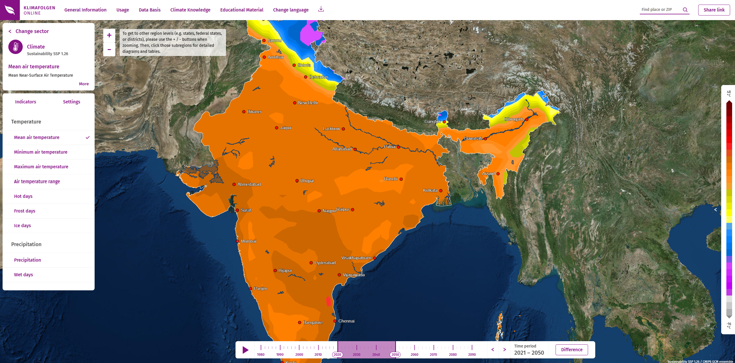
- Global and regional coverage including Europe, Africa, Asia, and the Americas
- Scenario-based projections using multiple climate models and emission pathways
- Interactive visualization tools for exploring climate impacts over time
- Mobile-optimized interface for accessibility across devices
Geographic Coverage
- Germany: Comprehensive data with ZIP code resolution and multiple sectors
- Europe: Continental analysis with climate zone differentiation
- Global regions: Central Asia, Sahel, Amazon, Ethiopia, Tanzania, Peru, India, Jordan
- Specialized focus areas: Congo basin (under development)
- Climate zones: Temperate, tropical, desert, Mediterranean, and humid tropical regions
Sectors and Indicators
- Agriculture: Crop yields, growing seasons, water requirements, and pest pressure
- Forestry: Tree species distribution, growth rates, and forest fire risk
- Biodiversity: Species habitat changes and ecosystem shifts
- Tourism: Temperature comfort, snow cover, and seasonal tourism potential
- Health: Heat stress, vector-borne disease risk, and air quality impacts
Applications
- Climate adaptation planning for municipalities and regions
- Agricultural planning and crop selection optimization
- Tourism industry planning for seasonal operations and infrastructure
- Health system preparedness for climate-related health risks
- Environmental conservation and ecosystem management
- Policy development for climate resilience strategies
Use Cases
- Local governments develop climate adaptation plans with location-specific data
- Farmers and agricultural cooperatives select climate-resilient crops and practices
- Tourism operators plan for changing seasonal patterns and weather conditions
- Public health authorities prepare for climate-related health challenges
- Conservation organizations prioritize areas for biodiversity protection
- Environmental impact evaluation for projects
- Research and analysis for academic and scientific purposes
- Policy development and regulatory compliance
- Educational and training applications
KlimafolgenOnline provides essential capabilities for understanding and addressing climate and nature-related challenges in today's changing world.