ESA WorldCover is the world's most detailed global land cover map at 10-meter resolution, providing comprehensive land use and land cover information derived from European Space Agency (ESA) Sentinel-1 and Sentinel-2 satellite observations.
Developed as part of ESA's Copernicus programme, WorldCover offers free access to unprecedented detail about Earth's land surface, including forests, croplands, urban areas, water bodies, and other land cover types, making it essential for environmental monitoring, climate research, and sustainable development planning.
Whether you're working on deforestation monitoring, urban planning, agricultural assessment, or biodiversity conservation, ESA WorldCover provides the high-resolution land cover intelligence needed for informed decision-making.
1. Unprecedented Global Resolution
ESA WorldCover delivers 10-meter resolution globally:
Technical Specifications:
- 10-meter pixel size worldwide
- Global coverage for all land areas
- Annual updates with the latest satellite data
- Sentinel-1 and Sentinel-2 satellite integration
- Machine learning classification algorithms
Data Quality:
- Overall accuracy exceeding 75% globally
- Validation using independent reference data
- Quality assessment layers included
- User accuracy and producer accuracy metrics
2. Comprehensive Land Cover Classes
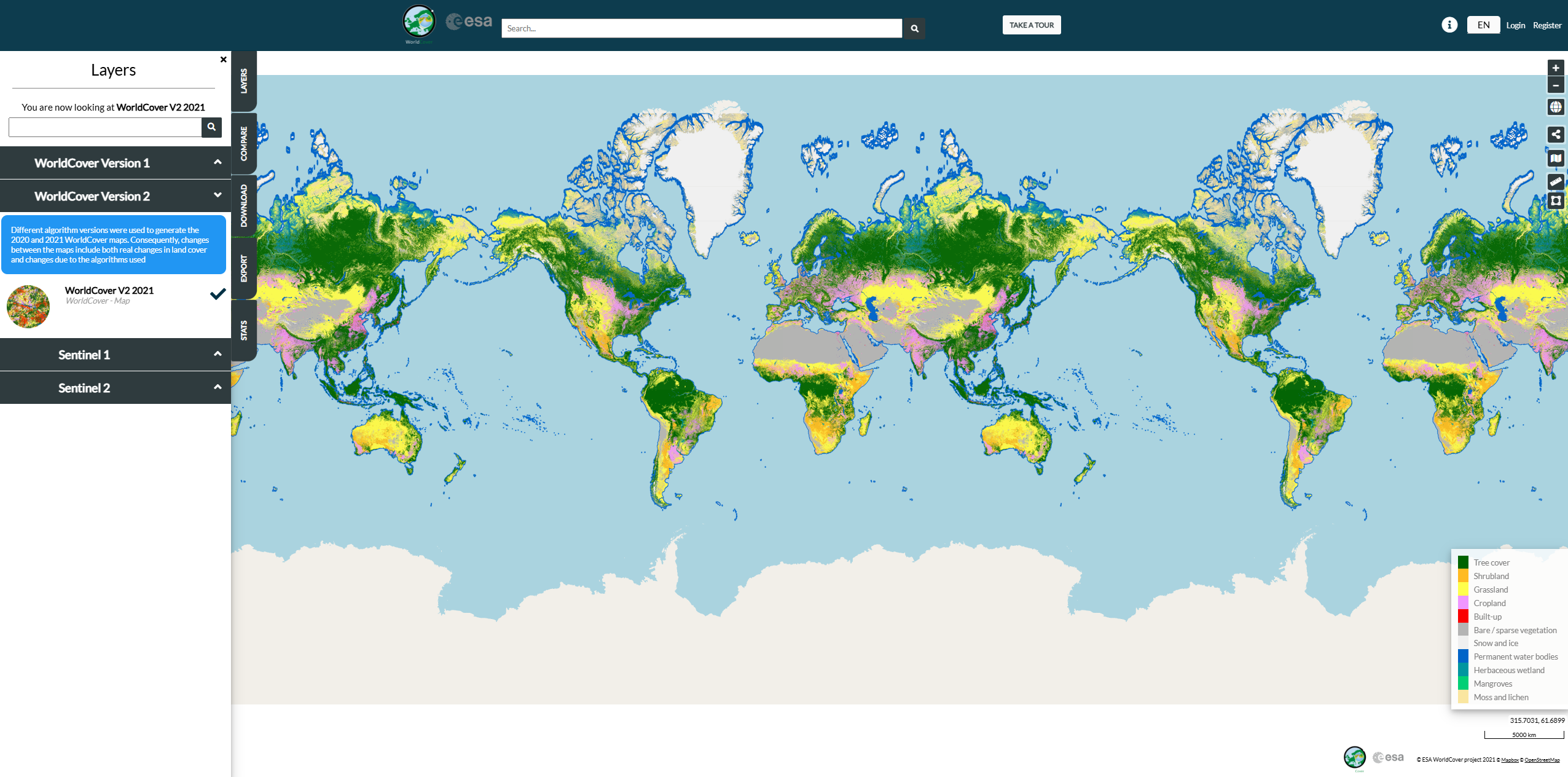
WorldCover classifies land into 11 primary land cover types:
Natural Vegetation:
- Tree cover (forests and woodlands)
- Shrubland and sparse vegetation
- Grassland and herbaceous vegetation
- Moss and lichen (Arctic/sub-Arctic regions)
Agricultural Areas:
- Cropland (annual and perennial crops)
- Built-up areas (urban and rural settlements)
Water and Wetlands:
- Permanent water bodies (lakes, rivers, oceans)
- Herbaceous wetland (marshes, swamps)
Other Cover Types:
- Mangroves (coastal ecosystems)
- Snow and ice (permanent snow cover)
- Bare/sparse vegetation (deserts, rocky areas)
3. Multiple Data Access Options
WorldCover offers flexible data access methods:
Interactive Web Viewer:
- Online visualization of global land cover
- Zoom capabilities from global to local scales
- Layer overlays and transparency controls
- Time series comparison tools
- Area statistics and analysis
Data Downloads:
- GeoTIFF format for GIS applications
- Tile-based downloads for specific regions
- Global mosaics for complete coverage
- Metadata and documentation included
Web Services:
- OGC-compliant web map services (WMS)
- REST API for automated data access
- Cloud platforms integration support
4. Change Detection Capabilities
WorldCover enables land cover change analysis:
- Annual land cover updates and comparisons
- Deforestation and reforestation monitoring
- Urban expansion tracking
- Agricultural land conversion analysis
- Restoration progress assessment
5. Applications Across Sectors
WorldCover supports diverse applications:
Environmental Monitoring:
- Deforestation and forest degradation tracking
- Biodiversity habitat mapping and assessment
- Protected area monitoring and management
- Ecosystem services quantification
Climate Research:
- Carbon stock estimation and monitoring
- Land use change climate impact assessment
- Albedo and surface energy balance studies
- Climate model input data
Sustainable Development:
- SDG indicator reporting and monitoring
- Land degradation neutrality assessment
- Food security and agricultural planning
- Water resource management support
Getting Started with ESA WorldCover
- Visit the WorldCover viewer at viewer.esa-worldcover.org
- Explore global land cover using the interactive map
- Select regions of interest for detailed analysis
- Compare different years to assess land cover changes
- Download data for offline analysis and integration
- Access technical documentation for methodology details
Use Cases
- Forest Monitoring: Track deforestation and forest restoration globally
- Urban Planning: Monitor urban expansion and land use change
- Agricultural Assessment: Map cropland distribution and agricultural expansion
- Biodiversity Conservation: Identify and monitor critical habitats
- Climate Research: Analyze land cover impacts on climate systems
- Policy Monitoring: Support REDD+, SDGs, and other international frameworks
ESA WorldCover democratizes access to the world's most detailed global land cover information, empowering users worldwide to monitor and understand Earth's changing land surface with unprecedented precision.