Climate Central provides cutting-edge interactive maps that show areas threatened by sea level rise and coastal flooding around the world.
This tool combines Climate Central's proprietary CoastalDEM® elevation model with the latest sea level projections from the IPCC and U.S. government task forces to deliver accurate coastal flood risk assessments.
Key Features
- CoastalDEM® Technology: High-accuracy digital elevation model for coastal areas using machine learning
- Global Coverage: Worldwide coastal flood risk screening, including areas without high-resolution elevation data
- Multiple Time Horizons: Explore sea level rise and flood threats by decade
- Climate Scenarios: Compare different warming pathways and their impacts on sea level rise
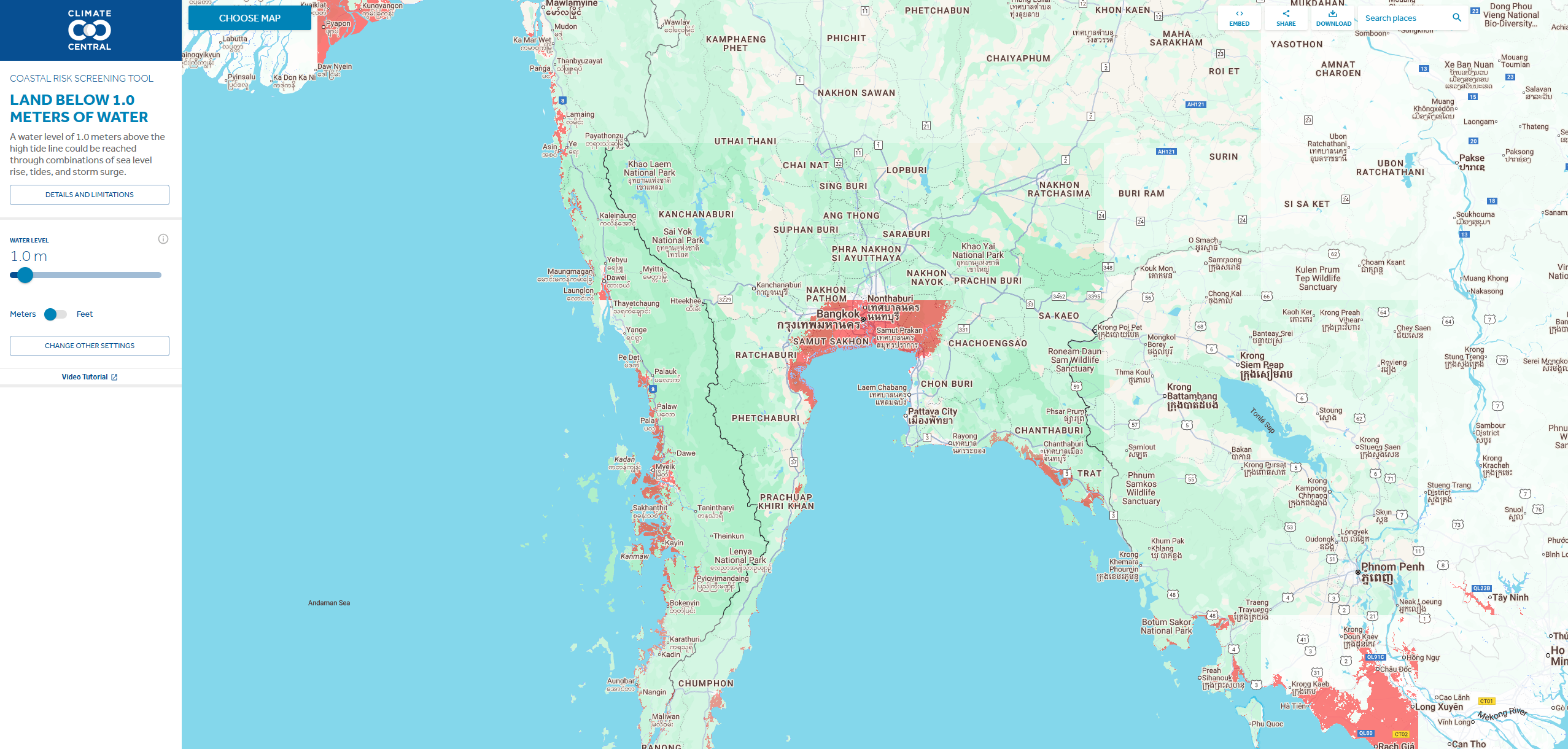
- Interactive Water Levels: Choose specific water levels to see potential flooding impacts
- U.S. Detailed Analysis: High-resolution mapping using NOAA airborne lidar data for U.S. coastal areas
Applications
- Coastal Planning: Assess flood risk for urban planning and infrastructure development
- Real Estate Analysis: Evaluate property-level flood risk from sea level rise
- Emergency Preparedness: Plan evacuation routes and emergency response strategies
- Insurance Assessment: Screen coastal properties for flood insurance risk
- Research and Education: Support climate science research and public education
- Policy Development: Inform coastal management and climate adaptation policies
Available Map Types
- Time Horizon Maps: See coastal flood threats by specific decades
- Water Level Maps: Choose flood levels and see affected areas
- Warming Scenario Maps: Compare long-term impacts under different climate scenarios
- Temperature Maps: Explore how different warming levels affect sea level rise
- Ice Sheet Maps: Understand how Antarctic and Greenland ice loss impacts different regions
- Affordable Housing Analysis: See how flooding affects low-income housing (U.S. only)
- Coastal Wetlands Maps: Explore wetland resilience to sea level rise
Use Cases
- Coastal Communities: Understand long-term flood risk for planning and adaptation
- Urban Planners: Design climate-resilient coastal development
- Emergency Managers: Prepare for coastal flooding and storm surge events
- Researchers: Access high-quality elevation and flood risk data for studies
- Property Developers: Assess coastal development risks and opportunities
- Environmental Groups: Advocate for coastal protection and climate action
- Government Agencies: Support evidence-based coastal management decisions
Climate Central's coastal risk screening tool provides essential data for understanding how rising seas will affect communities worldwide, helping users make informed decisions about coastal risk and adaptation.