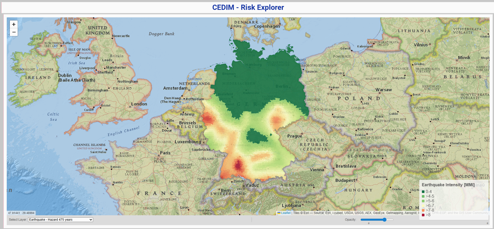
CEDIM Risk Explorer Germany is a comprehensive web-based mapping platform developed by the Center for Disaster Management and Risk Reduction Technology (CEDIM) at Karlsruhe Institute of Technology (KIT). The platform provides interactive maps showing natural hazard risks across Germany, including detailed risk assessments for 50-, 100-, and 500-year return period events.
The Risk Explorer presents research results from CEDIM's "Risk Map Germany" project, offering users the ability to explore hazard, vulnerability, and risk maps for various natural disasters including earthquakes, winter storms, and floods (specifically for Saxony), supporting evidence-based disaster risk management and planning.
Key Features
- Interactive hazard maps showing spatial distribution of natural disaster risks across Germany
- Multi-hazard coverage including earthquakes, winter storms, and flooding events
- Return period analysis for 50-, 100-, and 500-year events
- Vulnerability assessments showing potential damage percentages for different disaster scenarios
- Risk quantification displaying expected financial losses in specific time periods
- Asset value mapping showing spatial distribution of vulnerable infrastructure and buildings
Applications
- Disaster risk assessment for emergency planning and preparedness
- Insurance industry analysis for risk modeling and premium calculations
- Urban planning incorporating natural hazard considerations into development decisions
- Infrastructure planning identifying vulnerable areas for critical facilities placement
- Academic research providing data for natural disaster and risk reduction studies
- Public awareness educating communities about local natural hazard risks
Risk Components
- Hazard maps showing probability of natural phenomena occurrence in defined areas and time periods
- Vulnerability maps displaying susceptibility of buildings and infrastructure to damage
- Risk maps presenting expected financial damage from natural disasters over specific timeframes
- Asset value maps showing spatial distribution of exposed residential and commercial buildings
- Damage scenarios for different disaster magnitudes and return periods
Geographic Coverage
- Nationwide coverage of Germany with high-resolution risk assessments
- Regional detail allowing analysis at state and municipal levels
- Earthquake zones covering all seismically active areas in Germany
- Storm corridors showing winter storm pathways and intensity patterns
- Flood-prone areas particularly detailed coverage for Saxony region
Technical Capabilities
- Web-based interface accessible through standard browsers without software installation
- Interactive mapping with zoom, pan, and layer selection capabilities
- Data visualization showing risk levels through color-coded maps
- Scientific methodology based on peer-reviewed research and standardized risk assessment protocols
- Regular updates incorporating new research findings and improved methodologies
The CEDIM Risk Explorer Germany represents a significant advancement in natural disaster risk communication, providing essential information for disaster risk reduction, emergency planning, and climate adaptation strategies across Germany.