WESR Climate is an interactive climate data platform developed by the United Nations Environment Programme (UNEP) that analyzes climate change through the DPSIR framework - examining Drivers, Pressures, States, Impacts, and Responses related to climate change. This comprehensive approach helps users understand the complex relationships between human activities, environmental pressures, climate conditions, resulting impacts, and policy responses.
The platform provides evidence-based information to support climate policy development, adaptation planning, and decision-making by presenting climate data in a structured framework that connects causes, effects, and solutions.
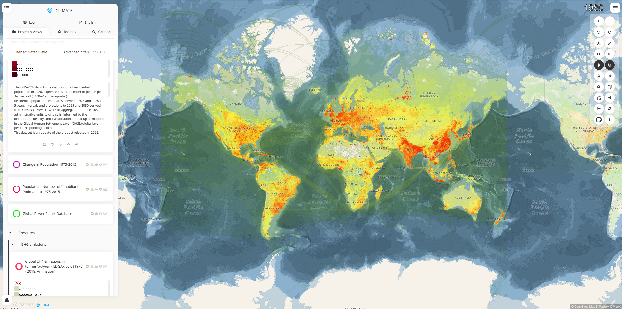
DPSIR Framework Components
- Drivers: Economic activities, population growth, energy consumption, and development patterns
- Pressures: Greenhouse gas emissions, land use changes, and human activities affecting climate
- States: Current climate conditions, temperature trends, precipitation patterns, and atmospheric composition
- Impacts: Effects on ecosystems, human health, agriculture, water resources, and economic systems
- Responses: Climate policies, mitigation measures, adaptation strategies, and international agreements
Key Features
- Interactive Climate Maps: Visualize climate data and indicators across different geographic scales
- DPSIR Analysis Tools: Structured approach to understanding climate change cause-and-effect relationships
- Indicator Dashboard: Track key climate indicators and their trends over time
- Policy Response Mapping: Visualize climate policies and their geographic implementation
- Impact Assessment: Analyze climate change impacts on various sectors and regions
- Scenario Exploration: Examine different climate and development scenarios
- Data Integration: Combine multiple climate datasets for comprehensive analysis
Climate Indicators
- Temperature: Global and regional temperature trends, heat waves, and thermal extremes
- Precipitation: Rainfall patterns, drought conditions, and extreme precipitation events
- Sea Level: Sea level rise, coastal flooding, and ocean thermal expansion
- Ice and Snow: Glacier retreat, ice sheet changes, and snow cover variations
- Atmospheric Composition: Greenhouse gas concentrations and atmospheric chemistry
- Extreme Events: Frequency and intensity of climate-related disasters
- Ocean Changes: Ocean warming, acidification, and marine ecosystem impacts
Applications
- Climate Policy Development: Support evidence-based climate policy formulation and evaluation
- Adaptation Planning: Identify climate vulnerabilities and develop adaptation strategies
- Impact Assessment: Evaluate current and projected climate change impacts
- Mitigation Strategy: Design and assess greenhouse gas reduction measures
- International Reporting: Support national communications and climate reporting obligations
- Research and Analysis: Provide data for climate science and policy research
- Education and Outreach: Communicate climate information to diverse audiences
Use Cases
- Government Climate Teams: Develop national climate strategies and adaptation plans
- International Organizations: Support global climate initiatives and country assistance programs
- Climate Researchers: Access structured climate data for scientific studies and analysis
- Policy Analysts: Evaluate effectiveness of climate policies and interventions
- Development Organizations: Integrate climate considerations into development planning
- Environmental Consultants: Support climate impact assessments and adaptation planning
- Educators: Teach climate science concepts using the DPSIR framework approach