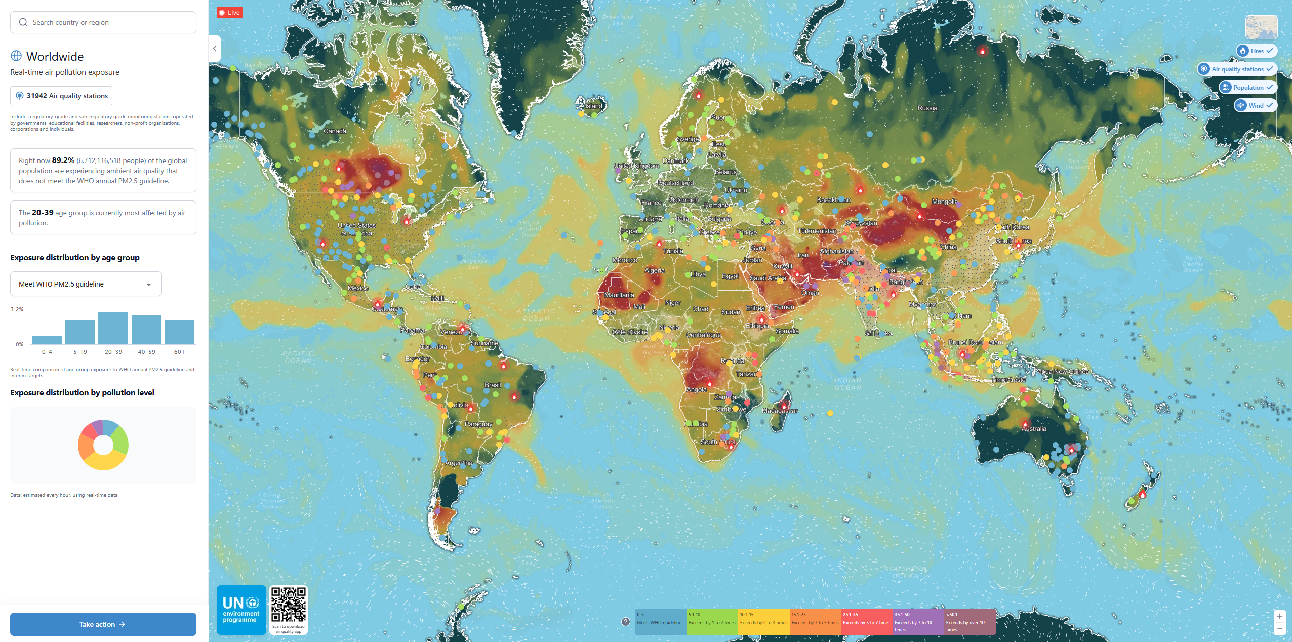
WESR Air Visual is a comprehensive global air quality monitoring platform developed through a partnership between IQAir and the United Nations Environment Programme (UNEP). The platform provides real-time access to air pollution data from over 32,000 monitoring stations worldwide, including both regulatory-grade government stations and community-operated sensors from diverse stakeholders.
This tool enables users to track air quality conditions globally, assess population exposure to air pollution, and understand the health impacts of poor air quality on communities worldwide, supporting evidence-based decision-making for air quality management and public health protection.
Key Features
- Real-Time Air Quality Data: Live updates from over 32,000 monitoring stations globally
- Interactive Global Map: Visualize air pollution levels worldwide with color-coded air quality indices
- Multiple Pollutants: Track PM2.5, PM10, ozone, nitrogen dioxide, sulfur dioxide, and carbon monoxide
- Population Exposure Analysis: Assess how many people are exposed to unhealthy air quality levels
- WHO Guideline Comparison: Compare current conditions against World Health Organization air quality standards
- Historical Data: Access historical trends and patterns in air quality measurements
- Mobile and Web Access: Available through web browsers and mobile applications
Data Sources
- Government Monitoring Networks: Regulatory-grade stations operated by environmental agencies
- Educational Institutions: University and research facility air quality monitors
- Corporate Networks: Air quality monitoring by private companies and organizations
- Community Sensors: Citizen science and low-cost sensor networks
- NGO Monitoring: Air quality data from non-profit environmental organizations
- Individual Contributors: Personal air quality monitors shared with the global network
Monitoring Capabilities
- PM2.5 and PM10: Fine and coarse particulate matter concentrations
- Gaseous Pollutants: Ozone, nitrogen dioxide, sulfur dioxide levels
- Air Quality Index: Standardized indices for easy public understanding
- Real-Time Updates: Hourly updates from active monitoring stations
- Geographic Coverage: Urban and rural areas across all continents
- Quality Assurance: Data validation and quality control processes
Applications
- Public Health Protection: Alert communities to unhealthy air quality conditions
- Environmental Policy: Support air quality regulation development and enforcement
- Urban Planning: Inform city planning and transportation decisions
- Health Research: Provide data for epidemiological studies on air pollution impacts
- Emergency Response: Monitor air quality during wildfires, industrial incidents, and dust storms
- Climate Action: Track air pollution as part of broader environmental monitoring
- Personal Health: Enable individuals to make informed decisions about outdoor activities
Use Cases
- Public Health Officials: Monitor air quality and issue health advisories to protect communities
- Environmental Agencies: Track pollution sources and evaluate effectiveness of air quality policies
- Urban Planners: Consider air quality in city development and transportation planning
- Health Researchers: Access global air pollution data for epidemiological studies
- Citizens and Families: Check local air quality before outdoor activities and exercise
- Media and Journalists: Report on air pollution events and environmental health issues
- International Organizations: Monitor global air quality trends and support environmental programs
