The Swiss Data Cube is an interactive mapping and data analysis platform that provides comprehensive access to Switzerland's water resources and environmental datasets. This tool integrates multiple data sources to offer detailed information about Swiss water systems, including hydrological data, water quality measurements, and environmental monitoring information across the country.
The platform supports water resource management, environmental research, and climate adaptation planning by providing high-quality, spatially explicit data about Switzerland's complex water systems, from alpine watersheds to lowland rivers and lakes.
Key Features
- Interactive Water Maps: Detailed mapping of Swiss rivers, lakes, watersheds, and water infrastructure
- Hydrological Data: Stream flow, water levels, precipitation, and snowpack information
- Water Quality Monitoring: Chemical, biological, and physical water quality parameters
- Spatial Analysis Tools: Advanced geospatial analysis capabilities for water resource assessment
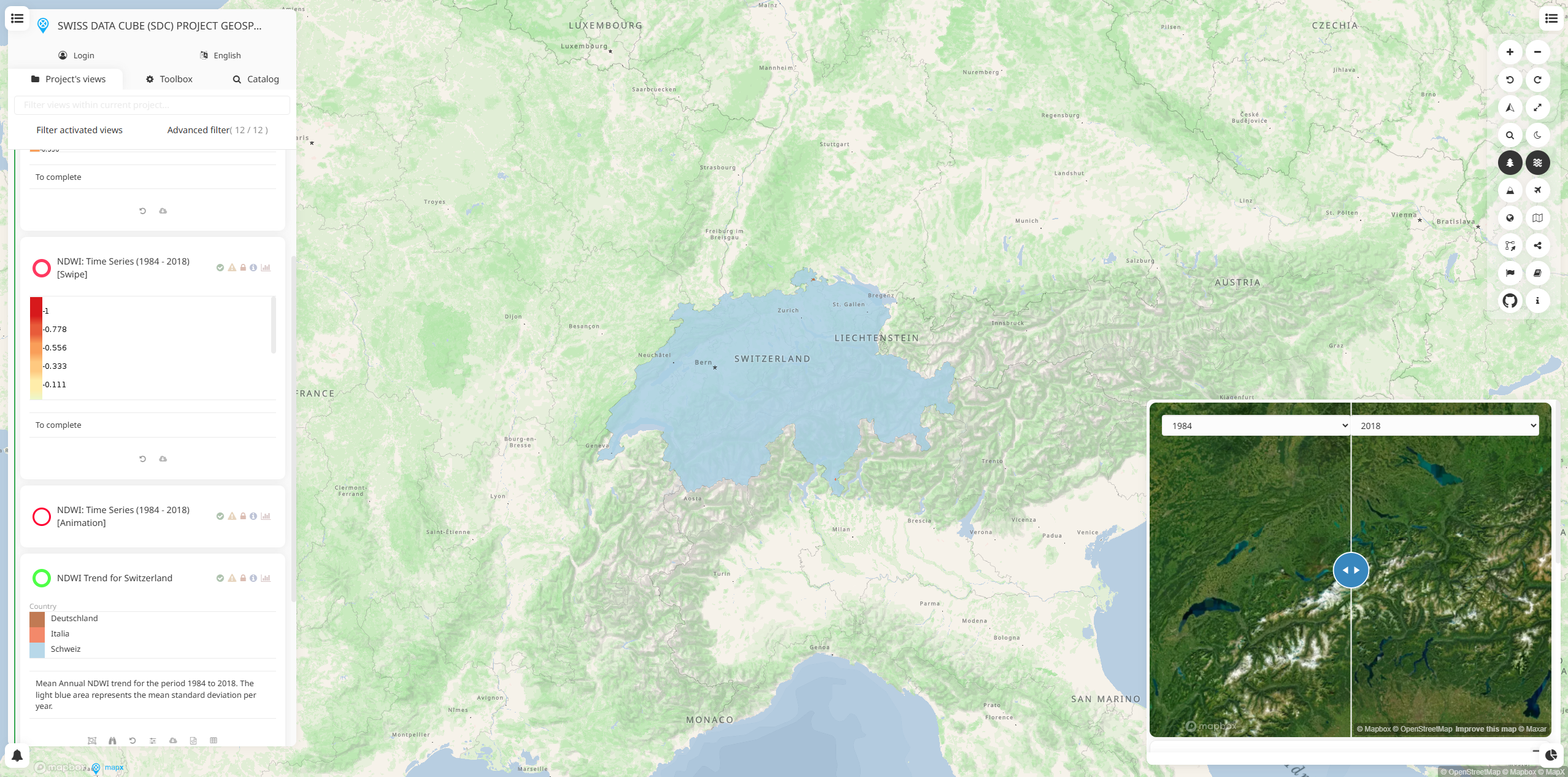
- Time Series Analysis: Historical and real-time data for trend analysis and monitoring
- Multi-Scale Data: Information available from local to national scales across Switzerland
- Data Download: Export capabilities for further analysis and integration with other tools
Data Categories
- Surface Water: Rivers, streams, lakes, and their hydrological characteristics
- Groundwater: Aquifer information, groundwater levels, and quality measurements
- Precipitation: Rainfall and snowfall data across different elevation zones
- Water Infrastructure: Dams, reservoirs, treatment plants, and distribution networks
- Water Quality: Chemical composition, pollution indicators, and ecological health metrics
- Climate Data: Temperature, evaporation, and other climate variables affecting water resources
- Land Use: Watershed characteristics and land cover impacts on water systems
Applications
- Water Resource Management: Support planning and operation of water supply systems
- Flood Risk Assessment: Analyze flood hazards and develop protection strategies
- Climate Impact Studies: Assess effects of climate change on Swiss water resources
- Environmental Monitoring: Track water quality and ecosystem health indicators
- Infrastructure Planning: Support design and placement of water infrastructure projects
- Research and Education: Provide data for academic studies and educational programs
- Policy Development: Inform water governance and regulatory decision-making
Regional Coverage
- Alpine Regions: High-altitude watersheds, glacial systems, and mountain hydrology
- Swiss Plateau: Lowland rivers, agricultural watersheds, and urban water systems
- Jura Mountains: Karst hydrology and unique groundwater systems
- Major River Basins: Rhine, Rhône, Po, and Danube basin components in Switzerland
- Lake Systems: Major lakes including Geneva, Constance, Neuchâtel, and smaller alpine lakes
Use Cases
- Water Utilities: Monitor water resources and plan supply system operations
- Environmental Agencies: Track water quality and enforce environmental regulations
- Hydropower Companies: Assess water availability for energy production planning
- Research Institutions: Conduct studies on Swiss hydrology and climate impacts
- Emergency Management: Monitor flood risks and support disaster response planning
- Agricultural Sector: Assess water availability for irrigation and crop planning
- Consultants: Support environmental impact assessments and water resource studies