IMPACT2C web atlas is an interactive climate impact assessment platform that visualizes the consequences of 2°C global warming across Europe and beyond.
This comprehensive atlas presents research findings from the IMPACT2C project, offering detailed maps and analyses of climate change impacts across multiple sectors including health, agriculture, energy, water resources, and coastal areas.
Key Features
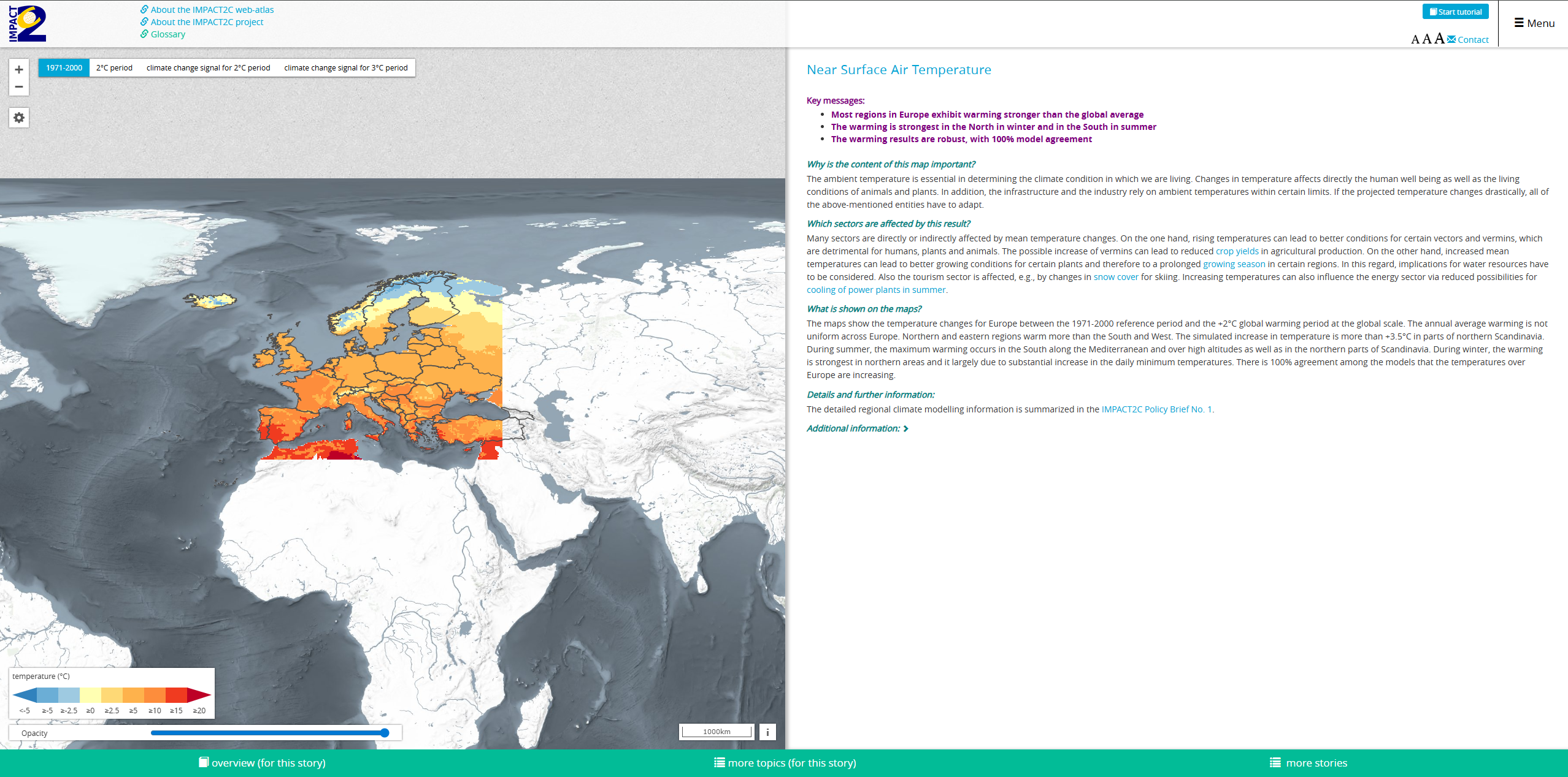
- 2°C warming scenario analysis showing specific impacts of reaching the Paris Agreement target
- Multi-sector impact assessment covering climate, tourism, energy, health, agriculture, water, and coastal themes
- Interactive mapping interface with detailed visualizations and data layers
- European focus with coverage of non-European climate hotspots
- Scientific evidence base from comprehensive climate impact modeling
- Sector-specific storylines explaining complex climate interactions
Impact Sectors
- Climate: Temperature and precipitation changes, extreme weather patterns
- Tourism: Seasonal shifts, snow cover impacts, and destination suitability
- Energy: Heating and cooling demand changes, renewable energy potential
- Health: Heat stress, disease patterns, and air quality impacts
- Agriculture and Forestry: Crop yields, growing seasons, and forest ecosystem changes
- Water Resources: Availability, quality, and seasonal distribution patterns
- Coastal Areas: Sea level rise, erosion, and coastal infrastructure risks
- Non-European Hotspots: Global implications beyond Europe
Applications
- Climate policy development for 2°C warming adaptation strategies
- Sectoral planning for agriculture, energy, and tourism industries
- Risk assessment for infrastructure and investment decisions
- Research and education on climate change impacts and adaptation
- International cooperation on global climate response strategies
- Public awareness campaigns on climate change consequences
Use Cases
- Policymakers develop evidence-based climate adaptation and mitigation policies
- Sectoral planners assess climate risks for agriculture, energy, and tourism sectors
- Researchers access comprehensive climate impact data for further studies
- Educators use visual materials to explain climate change impacts
- International organizations coordinate global climate response strategies
- Environmental impact evaluation for projects
- Research and analysis for academic and scientific purposes
- Policy development and regulatory compliance
- Educational and training applications
IMPACT2 web atlas provides essential capabilities for understanding and addressing climate and nature-related challenges in today's changing world.