GERICS – Climate Service Center Germany is a leading climate service institution operated by the Helmholtz-Zentrum Hereon that provides comprehensive climate information, data, and decision-support tools for climate adaptation in Germany. GERICS specializes in translating complex climate research into practical, actionable information for decision-makers at federal, state, and local levels.
The center produces detailed climate outlooks and fact sheets for all 401 German districts, federal states, and the entire country, supporting evidence-based climate adaptation planning through high-resolution climate projections, impact assessments, and specialized tools for urban planning, risk management, and sector-specific applications.
Key Features
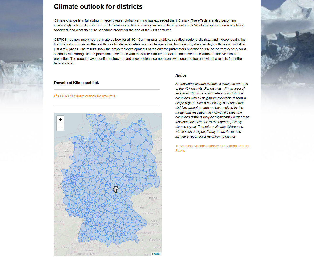
- District-level climate outlooks providing detailed projections for all 401 German counties and cities
- Federal state climate assessments offering comprehensive climate information for each of Germany's 16 states
- High-resolution climate modeling based on EURO-CORDEX regional climate simulations at 12.5 km resolution
- Standardized fact sheets enabling consistent climate information across different administrative levels
- CLIMDEX software providing automated, quality-controlled climate data analysis
- Multi-scenario projections covering high, moderate, and low climate protection scenarios
Applications
- Local government planning supporting climate adaptation strategies for districts and municipalities
- Urban climate planning using the GERICS city toolkit for climate-resilient urban development
- Risk assessment identifying climate vulnerabilities and extreme weather risks at local scales
- Infrastructure planning informing climate-resilient design for transportation, energy, and water systems
- Agricultural adaptation providing climate projections for farming and land management decisions
- Emergency preparedness supporting disaster risk reduction and climate hazard planning
Climate Products
- Temperature projections including trends in average temperatures, heat days, and tropical nights
- Precipitation analysis covering rainfall patterns, heavy precipitation events, and dry periods
- Extreme weather indicators tracking changes in heat waves, droughts, and storm patterns
- Seasonal climate information providing detailed seasonal outlook and trend analysis
- Climate indices offering standardized metrics for climate impact assessment
- Uncertainty assessments quantifying confidence levels and model agreement in projections
Geographic Coverage
- All 401 German districts including counties, regional counties, and independent cities
- 16 federal states with comprehensive state-level climate assessments
- National synthesis providing Germany-wide climate change overview
- Regional aggregation combining small districts for robust statistical analysis
- Cross-border context considering European-wide climate patterns and trends
Technical Methodology
- 85 regional climate simulations providing comprehensive ensemble modeling
- EURO-CORDEX data utilizing European coordinated regional climate downscaling
- HYRAS observational data from German Weather Service for historical baseline
- Quality control procedures ensuring robustness and reliability of climate projections
- Standardized analysis enabling consistent comparison across regions and time periods
- Model robustness classification indicating confidence levels in climate projections
Supporting Tools and Publications
- GERICS City Toolkit for urban climate adaptation planning and implementation
- Climate change reports providing comprehensive assessments for Germany
- Heavy rainfall analyses supporting flood risk assessment and urban drainage planning
- Climate risk management tools helping organizations identify and address climate vulnerabilities
- Training and capacity building supporting effective use of climate information
GERICS represents a critical bridge between climate science and practical climate adaptation, providing German decision-makers with the localized climate information necessary for effective climate resilience planning and implementation across all levels of government and society.