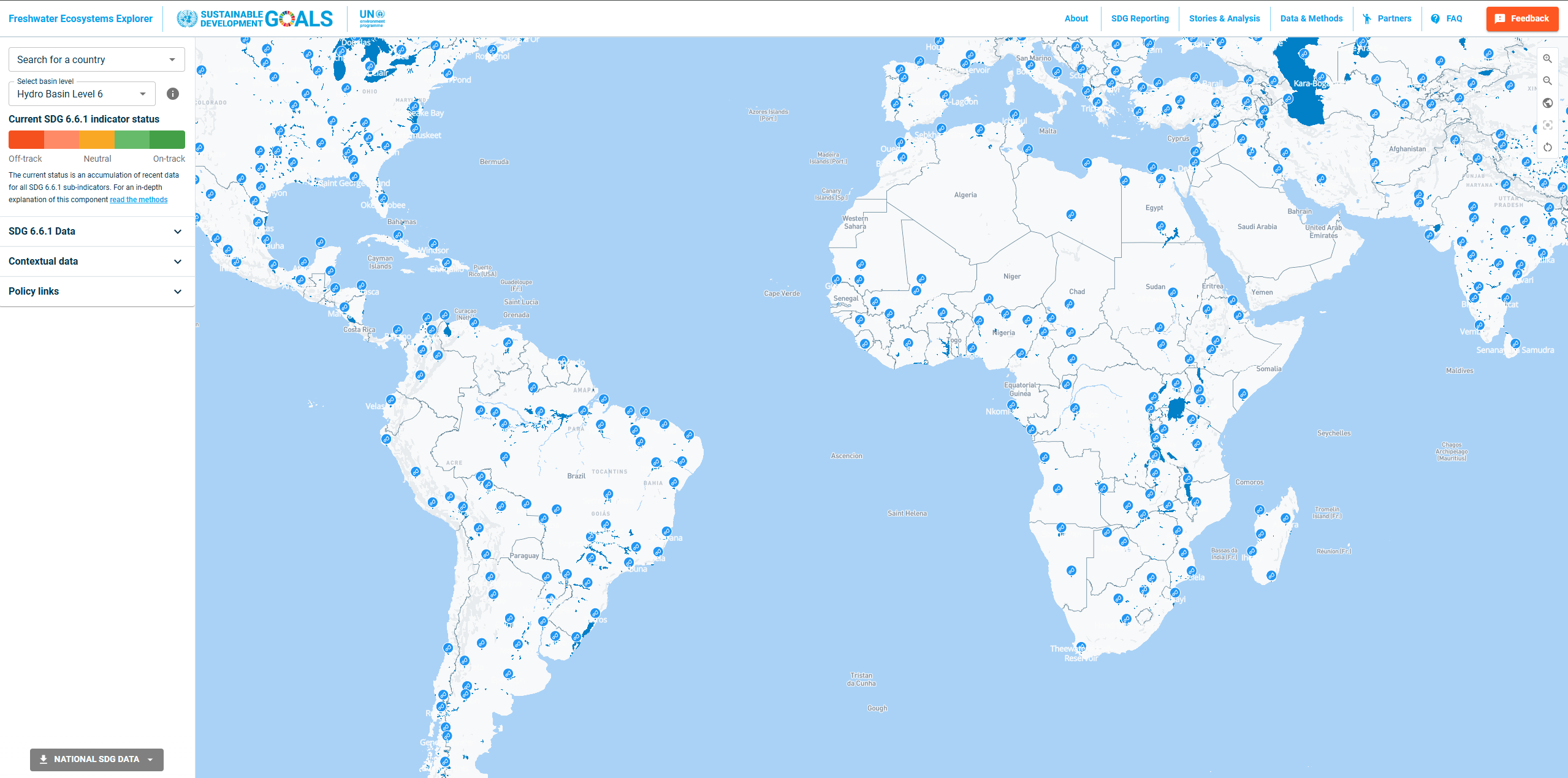
Freshwater Ecosystem Explorer is a United Nations-supported platform that tracks changes in the extent of water-related ecosystems including wetlands, rivers, estuaries, and other freshwater habitats to support global monitoring of freshwater biodiversity and ecosystem health.
Developed to support SDG 6.6.1 (change in the extent of water-related ecosystems over time), this tool provides essential data for understanding freshwater ecosystem trends and supporting conservation planning and policy development worldwide.
Whether you're involved in biodiversity monitoring, water resource management, conservation planning, or environmental reporting, the Freshwater Ecosystem Explorer provides critical insights into the state and trends of Earth's freshwater ecosystems.
1. SDG 6.6.1 Monitoring Support
The platform directly supports UN Sustainable Development Goal reporting:
SDG 6.6.1 Indicator:
- "Change in the extent of water-related ecosystems over time"
- Standardized methodology for global monitoring
- Baseline establishment and trend analysis
- National reporting support for UN member states
- Progress tracking toward SDG targets
2. Comprehensive Ecosystem Coverage
The tool monitors multiple types of water-related ecosystems:
Wetland Ecosystems:
- Inland wetlands (marshes, swamps, bogs)
- Coastal wetlands (mangroves, salt marshes)
- Constructed wetlands and managed areas
- Seasonal and permanent water bodies
Freshwater Systems:
- Rivers and streams of all sizes
- Lakes and reservoirs
- Springs and groundwater-dependent ecosystems
- Floodplains and riparian zones
Estuarine Areas:
- River deltas and estuarine systems
- Brackish water habitats
- Coastal transition zones
3. Temporal Change Analysis
The platform provides time series analysis capabilities:
- Multi-year trend analysis and visualization
- Ecosystem extent change quantification
- Loss and gain identification
- Restoration progress monitoring
- Climate impact assessment on ecosystem extent
4. Global and Regional Monitoring
The tool offers flexible geographic analysis:
Global Overview:
- Worldwide ecosystem distribution mapping
- Regional trend comparisons
- Country-level summaries and statistics
- Cross-border ecosystem monitoring
Local Analysis:
- Watershed-level ecosystem assessment
- Protected area monitoring
- Restoration site tracking
- Impact assessment for development projects
5. Scientific Methodology and Data Sources
The platform employs rigorous scientific approaches:
- Remote sensing data integration
- Ground-truth validation and verification
- Standardized classification systems
- Quality assurance protocols
- Peer-reviewed methodology development
6. Policy and Conservation Applications
The tool supports evidence-based decision making:
Conservation Planning:
- Priority area identification
- Restoration target setting
- Protected area effectiveness assessment
- Biodiversity corridor planning
Policy Development:
- National biodiversity strategies support
- Water resource management planning
- Climate adaptation strategy development
- Environmental impact assessment
Getting Started with Freshwater Ecosystem Explorer
- Visit the platform at map.sdg661.app
- Explore the interactive map to view ecosystem distributions
- Select regions of interest for detailed analysis
- Analyze temporal trends using time series tools
- Download data and reports for further analysis
- Access methodology documentation for implementation
Use Cases
- SDG Reporting: Support national SDG 6.6.1 indicator reporting
- Conservation Planning: Identify priority areas for freshwater ecosystem protection
- Environmental Monitoring: Track ecosystem health and restoration progress
- Policy Development: Inform water resource and biodiversity policies
- Research Applications: Study freshwater ecosystem dynamics and trends
- Impact Assessment: Evaluate development impacts on freshwater ecosystems
The Freshwater Ecosystem Explorer provides essential monitoring capabilities for understanding and protecting Earth's critical freshwater ecosystems, supporting global efforts to achieve sustainable development goals and biodiversity conservation targets.