Deutscher Klimaatlas (German Climate Atlas) is an interactive web-based platform developed by the German Meteorological Service (Deutscher Wetterdienst - DWD) that provides comprehensive climate information for Germany. The atlas presents historical climate data, current conditions, and future climate projections through detailed maps and visualizations, serving as the authoritative source for German climate information.
The platform offers access to climate normals, current deviations from historical averages, and climate scenario projections through 2100, supporting climate adaptation planning, research, and public understanding of climate change impacts across Germany.
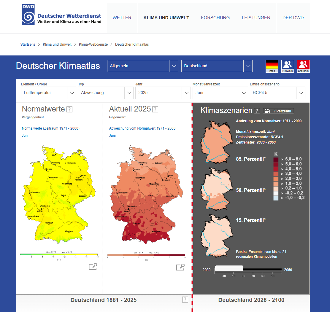
Key Features
- Historical climate normals showing baseline climate conditions for periods 1961-1990 and 1971-2000
- Current climate monitoring displaying real-time deviations from historical averages
- Future climate scenarios based on regional climate models and RCP emission pathways
- Interactive mapping interface with zoom, pan, and layer selection capabilities
- Time series analysis showing climate trends from 1881 to 2100
- Statistical analysis tools including percentile calculations and ensemble modeling
Applications
- Climate impact assessment for infrastructure planning and risk management
- Agricultural planning supporting crop selection and farming adaptation strategies
- Urban planning incorporating climate considerations into city development
- Energy sector analysis for heating, cooling, and renewable energy planning
- Scientific research providing data for climate studies and impact assessments
- Public education increasing awareness of climate change impacts in Germany
Climate Variables
- Air temperature including daily, monthly, and seasonal averages and extremes
- Precipitation covering rainfall amounts, frequency, and seasonal patterns
- Sunshine duration and solar radiation measurements
- Wind patterns including speed, direction, and seasonal variations
- Humidity levels and atmospheric pressure measurements
- Extreme weather indices tracking heat waves, cold spells, and precipitation extremes
Temporal Coverage
- Historical baseline periods (1961-1990, 1971-2000) for climate normal calculations
- Current monitoring (2025) showing real-time climate conditions and anomalies
- Near-term projections (2030-2060) for immediate adaptation planning
- Long-term scenarios (2071-2100) for strategic infrastructure and policy planning
- Trend analysis from 1881 to present showing long-term climate evolution
Climate Scenarios
- RCP4.5 emissions pathway representing moderate climate change scenarios
- Ensemble modeling incorporating up to 21 regional climate models for uncertainty assessment
- Percentile analysis (15th, 50th, 85th percentiles) showing range of possible outcomes
- Regional downscaling providing high-resolution climate projections for local areas
- Seasonal projections showing how climate change affects different times of year
Technical Capabilities
- High-resolution mapping providing detailed spatial climate information across Germany
- PDF export functionality for downloading maps and charts for offline use
- Multi-language support with English version available for international users
- Mobile-responsive design ensuring accessibility across different devices
- Quality-controlled data based on DWD's extensive meteorological observation network
The Deutscher Klimaatlas represents a critical resource for understanding climate change impacts in Germany, supporting evidence-based adaptation planning, and promoting climate awareness among researchers, planners, and the general public.