AQUEDUCT Water Risk Atlas is a comprehensive water risk mapping tool developed by the World Resources Institute (WRI) that provides detailed information on water stress, precipitation variability, water supply and demand, and water quality across the globe.
This free, interactive platform helps businesses, investors, governments, and researchers understand and quantify water-related risks at local, national, and global levels, supporting informed decision-making for water security and sustainability.
Whether you're assessing supply chain vulnerabilities, investment risks, policy planning, or corporate water stewardship, AQUEDUCT provides essential data and analysis tools for building water resilience in an increasingly water-stressed world.
1. Comprehensive Water Risk Indicators
AQUEDUCT provides multiple water risk indicators covering:
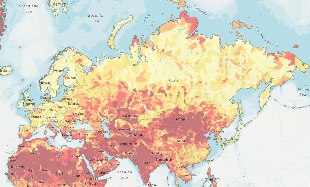
Baseline Water Stress:
- Water supply vs. demand ratios
- Seasonal and annual water availability
- Competition for water resources
- Regional water scarcity assessments
Water Quality:
- Untreated wastewater discharge levels
- Coastal eutrophication potential
- Water pollution indicators
- Treatment infrastructure adequacy
Future Projections:
- Groundwater depletion trends
- Drought frequency and severity changes
- Flood risk projections
- Water demand growth scenarios
2. Interactive Mapping Platform
The tool features powerful visualization capabilities:
- High-resolution maps showing water risk globally
- Country and basin-level analysis
- Custom area selection for specific regions
- Multi-layered data visualization
- Time series analysis for trend identification
Users can overlay different risk indicators to understand complex water challenges.
3. Business and Investment Applications
AQUEDUCT is specifically designed for practical applications:
- Supply chain risk assessment
- Facility location planning
- Investment risk evaluation
- Due diligence processes
- ESG reporting and disclosure
The tool helps organizations identify high-risk locations and develop mitigation strategies.
4. Scenario Analysis and Projections
The platform includes future projections:
- Climate change impacts on water availability
- Population growth and demand projections
- Economic development scenarios
- Multiple time horizons (2030, 2040, 2080)
- Different emission pathways
5. Data Export and Integration
AQUEDUCT offers flexible data access:
- CSV downloads for analysis
- API access for automated data retrieval
- GIS integration capabilities
- Custom reporting tools
- Bulk data downloads for research
Getting Started with AQUEDUCT
- Visit the platform at wri.org/applications/maps/aqueduct-atlas
- Explore the global map to understand water risks
- Select specific regions for detailed analysis
- Layer different indicators to assess comprehensive risk
- Download data for further analysis and planning
Use Cases
- Corporate Water Stewardship: Assess and manage water risks across operations
- Investment Analysis: Evaluate water-related investment risks
- Supply Chain Management: Identify vulnerable suppliers and regions
- Policy Development: Support water resource management policies
- Research: Access standardized global water risk data
- Sustainability Reporting: Support ESG and CDP water disclosure
AQUEDUCT Water Risk Atlas provides the critical water intelligence needed to build resilience and sustainability in an increasingly water-stressed world.