Area Calculator
Draw shapes directly on the map and get accurate area measurements in seconds.
Calculate Area
Draw shapes directly on the map and get accurate area measurements in seconds.
How to Calculate Polygon Area on a Map
Zoom to your area of interest
Use the map controls to zoom in on the area you want to measure.
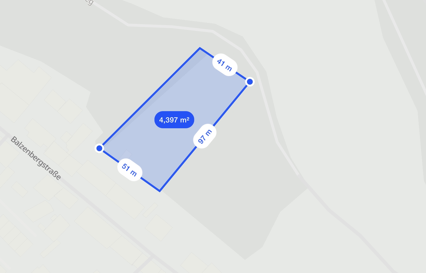
Draw your polygon
Click on the map to create points. Close the shape by clicking on the first point.
See area calculation instantly
The area will be calculated and displayed in the sidebar. You can adjust the polygon by dragging points.
Save or export results
You can save the area calculation or export it for further analysis. Use the reset button to start over.
Use Cases for Polygon Area Calculation
Urban Planning
Calculate land use areas, zoning boundaries, and green spaces for city planning.
Agriculture & Land Measurement
Measure field sizes, crop areas, and land parcels for agricultural planning.
Environmental Monitoring
Assess habitat areas, conservation zones, and pollution impact zones.
What Is the Polygon Area Calculator?
It’s a simple tool that lets you draw any shape on a map — and instantly tells you the area. Just click to create a polygon, and we’ll calculate the size in square meters, kilometers, acres, or whatever unit you need.
Frequently asked questions
Learn more about our area calculator tool