This week brings the public release of our Templates gallery, imperial unit support for workflows, animated number widgets, and a host of improvements across mobile, data tables, and the map interface.
Features
Templates gallery now available to all users
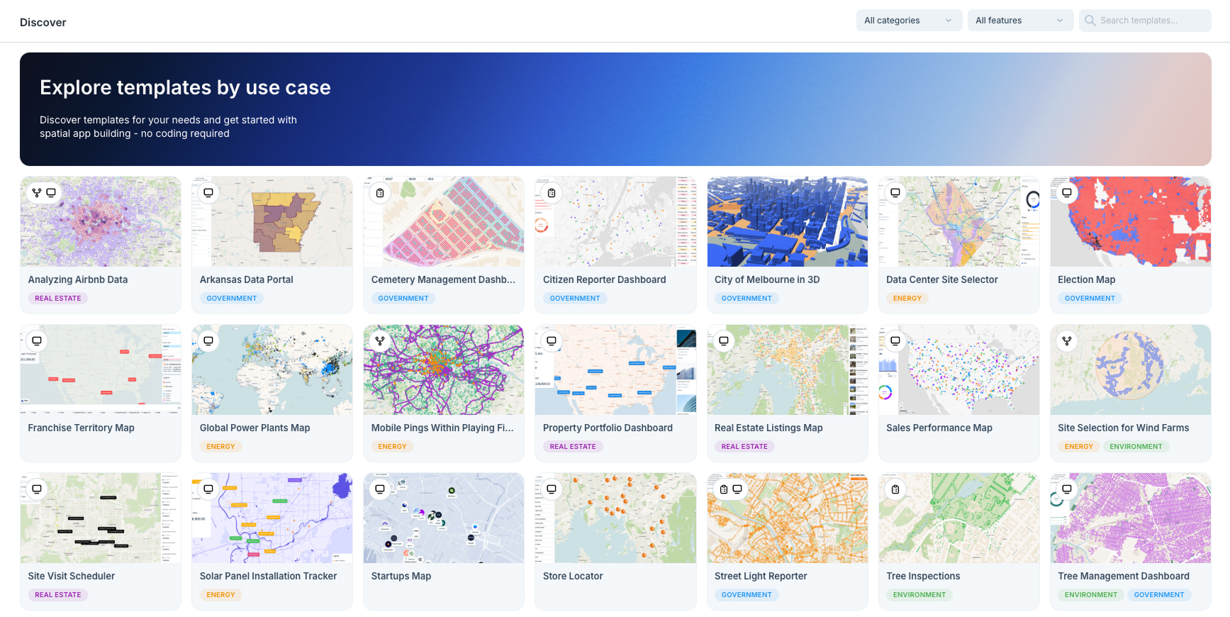
The Discover page with project templates is now publicly available. Browse up to 20 templates to jumpstart your projects—from urban planning to environmental analysis. Find the perfect starting point and customize it to your needs.
Imperial units in workflow nodes
Unit-aware workflow nodes now support imperial measurements. Whether you're working in meters or feet, miles or kilometers, Atlas adapts to your preferred unit system throughout your analysis pipelines.
Animated number widgets
Number widgets now animate when their values update, creating a smooth "slot machine" style transition. This makes real-time data changes more noticeable and adds visual polish to your dashboards.
FeatureServer styling with custom icons
Added comprehensive support for FeatureServer styling with custom icon images. Vector layers from ArcGIS FeatureServer connections now display with their original icons and symbology, including data-driven icon legends.
New formula functions
Expanded the formula language with new mathematical functions: POW (exponentiation), MOD (remainder), FACTORIAL, and NOT. We also improved readability by changing the not operator from ~ to the more familiar !.
Hillshade angle slider
Control hillshade visualization with a new angle slider, giving you precise control over the simulated light direction for terrain visualization.
Fixes and Improvements
- Fixed form dataset selector getting stuck on "Create new dataset"
- Fixed shapefile uploads when dragged directly onto the map
- Preserved linebreaks in Navi chat responses
- Added imperial unit support across unit-aware workflow nodes
- Fixed chart widget legend and chip overlapping
- Fixed boolean fields incorrectly displaying as "(empty)"
- Fixed user cells showing "Deactivated user" during loading
- Fixed tabs content disappearing in certain configurations
- Preserved filter state when switching between tabs in Tabs Widget
- Fixed popup elements not being possible to add in some cases
- Fixed image display in popup within feature list widget on mobile
- Improved timeline player controls styling
- Improved styling panel buttons with proper hover effects
- Made dragging widgets into sections easier with larger drop targets
- Fixed hover popup functionality on embedded maps
- Fixed country borders appearing above fill layers in basemaps
- Fixed geocoded column selection in widgets
- Fixed shade map date change issues
- Fixed 3D mode no longer automatically changing map projection
- Fixed range sliders not working on mobile devices
- Limited mobile sections to prevent navigation bar overflow
- Made popup elements more compact
- Improved account modal by organizing password fields in an accordion
- Better error messages when location access fails
- Added disabled state with tooltip for "Add field" button on read-only datasets
- Fixed horizontal scroller visibility in data table on mobile
- Improved comments with better mobile usability, tag color persistence, and duplicate prevention
- Fixed cursor jumping in workflow note nodes
- Fixed legend label editing for custom text values
- Fixed empty values in color palette
- Improved history component design
- Streamlined empty state to show only top 5 integrations
- Updated MapLibre to latest version with performance improvements
- Fixed copy/paste for images with special characters
- Improved lookup value formatting in data tables
- Fixed sorting in relations dialog
- Fixed filtering for widgets with newly created columns