Data Sources/WorldClim

WorldClim

WorldClim provides free, high-resolution climate data, including temperature, precipitation, and future climate projections.

Climate Analysis

Analyze climate patterns, weather trends, and atmospheric conditions for research, risk assessment, and long-term planning.

Biodiversity & Conservation

Monitor species habitats, protected areas, and ecosystem changes to support conservation and biodiversity management.

Agriculture & Land Use

Monitor crop health, soil conditions, and land use changes for precision agriculture and sustainable land management.

WorldClim

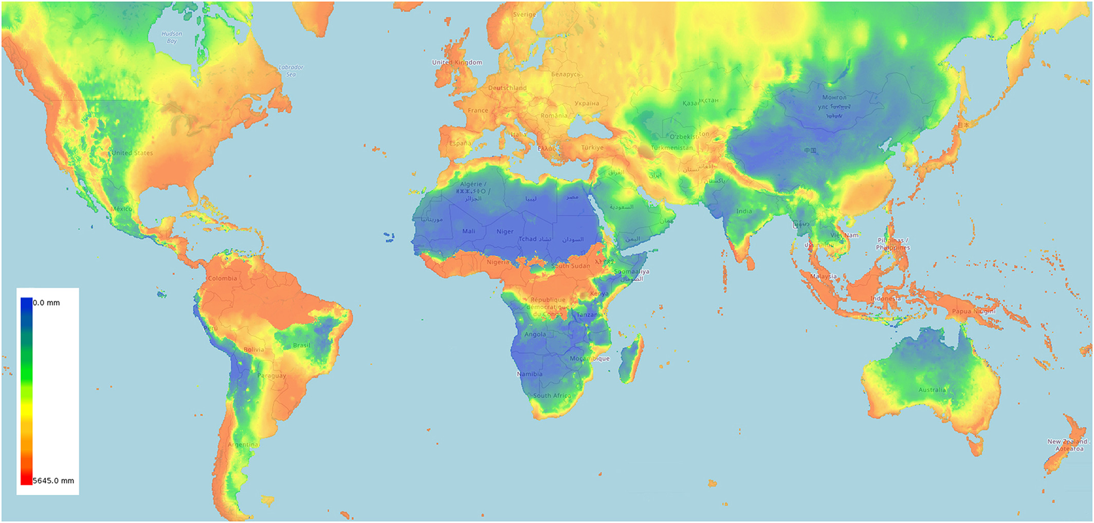
WorldClim is the most cited climate dataset in ecological research — and for good reason. Its 19 bioclimatic variables have become the de facto standard input for species distribution modeling, capturing ecologically meaningful patterns like temperature seasonality, precipitation of the driest quarter, and mean temperature of the warmest month at 1 km resolution globally.

When a biodiversity study uses "climate data" as a predictor layer, it almost certainly means WorldClim. The dataset interpolates weather station observations with corrections for elevation and topography, producing spatial climate surfaces that represent long-term averages rather than individual weather events — which is exactly what ecological niche models need.

WorldClim's position in the ecosystem is complementary to ERA5 and CHELSA rather than competitive. ERA5 provides hourly temporal resolution but at coarser spatial scale (31 km) — designed for weather, energy, and atmospheric analysis. CHELSA matches WorldClim's spatial resolution but uses different downscaling methods that perform better in mountainous terrain.

WorldClim's advantage is its entrenched position in ecology: the bioclimatic variables, the modeling community built around them, and the availability of matching CMIP6 future projections under the same framework mean that choosing WorldClim gives you compatibility with the largest body of published ecological research. For new projects in species modeling, agricultural suitability, or biodiversity assessment, WorldClim remains the practical default — use CHELSA as a complementary check, especially in topographically complex regions.

How to use WorldClim in Atlas?

Frequently Asked Questions

Temperature (min, max, mean), precipitation, solar radiation, wind speed, and humidity — available as monthly averages and 19 bioclimatic variables derived from temperature and precipitation.

WorldClim offers data at multiple resolutions from 10 minutes (~340 km²) down to 30 arc-seconds (~1 km²). The 1 km resolution is the most commonly used for ecological and biodiversity studies.

Yes. WorldClim provides downscaled future climate data from global climate models (GCMs) for multiple greenhouse gas scenarios (SSPs/RCPs) covering time periods from 2021 to 2100.

Yes. All WorldClim datasets are completely free to download from worldclim.org in GeoTIFF format, ready for use in GIS software.

WorldClim provides high-resolution spatial averages ideal for species distribution modeling and ecological studies. ERA5 offers hourly temporal resolution but at coarser spatial resolution (31km). CHELSA provides similar spatial detail to WorldClim with different downscaling methods.

Details

CoverageGlobal
Layer TypeRaster
Update FrequencyStatic
Categories
Climate
Visit sourceUse data in Atlas