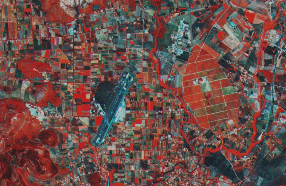
If you need high-quality satellite imagery for environmental monitoring, disaster response, or GIS projects, Copernicus Open Access Hub is one of the best free data sources available.
Operated by the European Space Agency (ESA), the Copernicus Open Access Hub provides access to Sentinel satellite data, offering detailed Earth observation imagery for scientists, researchers, and GIS professionals.
Let’s explore why Copernicus Open Access Hub is a must-have resource for geospatial analysis.
1. Free and Open Access to High-Resolution Satellite Data
Unlike commercial providers that charge for satellite imagery, Copernicus Open Access Hub is completely free.
✔ No licensing fees
✔ No restrictions on usage
✔ Global coverage
This makes it a valuable resource for governments, researchers, and businesses that need reliable remote sensing data without budget constraints.
2. Access to the Sentinel Satellite Program
Copernicus Open Access Hub provides data from the Sentinel satellite constellation, which offers multispectral, radar, and atmospheric data.
Sentinel Mission | Data Type | Best For |
---|---|---|
Sentinel-1 | Radar (SAR) | Flood mapping, land deformation, maritime monitoring |
Sentinel-2 | Optical multispectral imagery | Land cover, vegetation monitoring, agriculture |
Sentinel-3 | Ocean and land observation | Sea surface temperature, water quality, land mapping |
Sentinel-5P | Atmospheric monitoring | Air pollution, greenhouse gases, climate studies |
With frequent global coverage, Sentinel data is ideal for monitoring changes over time.
3. High Temporal and Spatial Resolution
Copernicus Open Access Hub provides frequent updates, ensuring that you always have recent satellite images.
- Sentinel-1 captures radar images every 6-12 days.
- Sentinel-2 provides optical images every 5 days at 10-meter resolution.
- Sentinel-3 delivers daily ocean and land data.
This high temporal resolution makes it possible to track changes over time, such as:
- Deforestation and land use changes
- Urban expansion and infrastructure growth
- Seasonal agricultural patterns
- Glacier movement and climate change impact
4. Cloud-Penetrating Radar Data (Sentinel-1)
Most optical satellite images are affected by cloud cover, making it hard to get clear images during bad weather.
However, Sentinel-1 uses Synthetic Aperture Radar (SAR), which works day and night, in any weather condition.
This is particularly useful for:
- Disaster response (flood mapping, landslides)
- Deforestation monitoring in tropical areas
- Maritime surveillance (oil spills, ice monitoring)
For users who need consistent and cloud-free imagery, Sentinel-1 data is a game-changer.
5. Multispectral Data for Vegetation and Land Use Analysis (Sentinel-2)
Sentinel-2 provides multispectral imagery at a 10-60 meter resolution, making it ideal for:
- Vegetation health assessment (NDVI analysis)
- Agriculture monitoring (crop growth, drought detection)
- Land cover classification (urban, forest, water bodies)
With its frequent revisit times and high resolution, Sentinel-2 is widely used for environmental monitoring and precision agriculture.
6. Ocean and Climate Data (Sentinel-3 and Sentinel-5P)
For oceanographers, climatologists, and environmental scientists, Sentinel-3 and Sentinel-5P offer crucial data on:
- Sea surface temperature
- Water quality and algae blooms
- Air pollution and greenhouse gases
- Wildfire smoke and ozone levels
These datasets are vital for climate change research and disaster mitigation.
7. Multiple Data Formats and GIS Compatibility
Copernicus Open Access Hub provides data in standard GIS formats, making it easy to use in:
- QGIS and ArcGIS (GeoTIFF, NetCDF)
- Python and R (APIs for data processing)
- Google Earth Engine (Cloud-based analysis)
This flexibility ensures that researchers and professionals can integrate Sentinel data into their workflows easily.
8. Global Coverage for Any Region
Unlike some commercial providers that focus on specific regions, Copernicus Open Access Hub offers global data.
This makes it ideal for projects in:
- Remote and developing regions with limited commercial satellite data.
- Disaster-prone areas needing rapid response imagery.
- Large-scale environmental studies requiring global datasets.
No matter where you need data, Sentinel satellites have comprehensive coverage.
How to Get Started with Copernicus Open Access Hub
1. Access the Portal
Visit Copernicus Open Access Hub to start exploring Sentinel data.
2. Search for Data
- Define your area of interest using coordinates or drawing a bounding box.
- Select Sentinel missions and apply filters like date range, cloud cover, and resolution.
3. Download the Data
- Download full-resolution Sentinel imagery for free.
- Process it using QGIS, ArcGIS, or cloud-based platforms.
4. Analyze and Use the Data
- Perform NDVI analysis for vegetation health.
- Use Sentinel-1 radar for flood and infrastructure mapping.
- Analyze air pollution trends with Sentinel-5P.
Final Thoughts
If you need free, high-resolution, and frequently updated satellite imagery, Copernicus Open Access Hub is one of the best data sources available.
With Sentinel satellite data, GIS professionals, researchers, and environmental analysts can access detailed Earth observation data for:
- Urban planning and land monitoring
- Agriculture and forestry
- Disaster response and climate change research
- Maritime and atmospheric studies
Start exploring and downloading Sentinel data today at Copernicus Open Access Hub.