When choosing a GIS platform, ease of use and the amount of training required are critical considerations. Whether you’re a GIS beginner or an experienced user looking for efficiency, the time investment needed to create maps can significantly impact your workflow.
Atlas and QGIS represent two different approaches to GIS. Atlas focuses on simplicity and accessibility, while QGIS offers extensive functionality that comes with a steeper learning curve. Let’s compare how much training each platform requires for easy map creation.
First Impressions: Ease of Getting Started
Atlas: Ready to Use in Minutes
Atlas is a browser-based platform that eliminates the need for downloads or installations. New users can sign up, log in, and start creating maps almost immediately.
Why it’s easy to get started with Atlas:
- Intuitive drag-and-drop interface.
- Pre-built templates for quick map creation.
- Clear navigation that guides users through key steps.
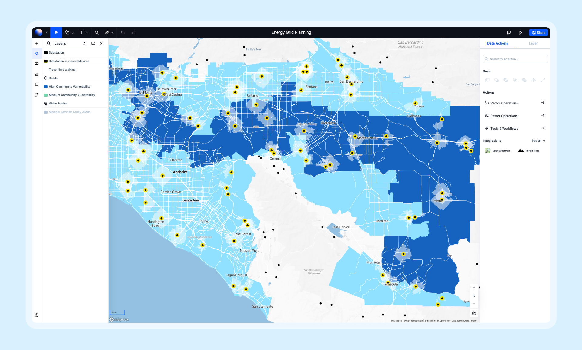
Atlas’s design focuses on reducing the barriers for beginners, allowing users to jump into map-making without prior GIS experience.
QGIS: Setup and Installation Required
QGIS, as a desktop application, requires downloading and installing software before use. This process is straightforward for technical users but may feel daunting to non-technical users.
Challenges for beginners:
- Installing the correct version for your operating system.
- Managing external dependencies or plugins for added functionality.
- Navigating a complex interface packed with advanced tools.
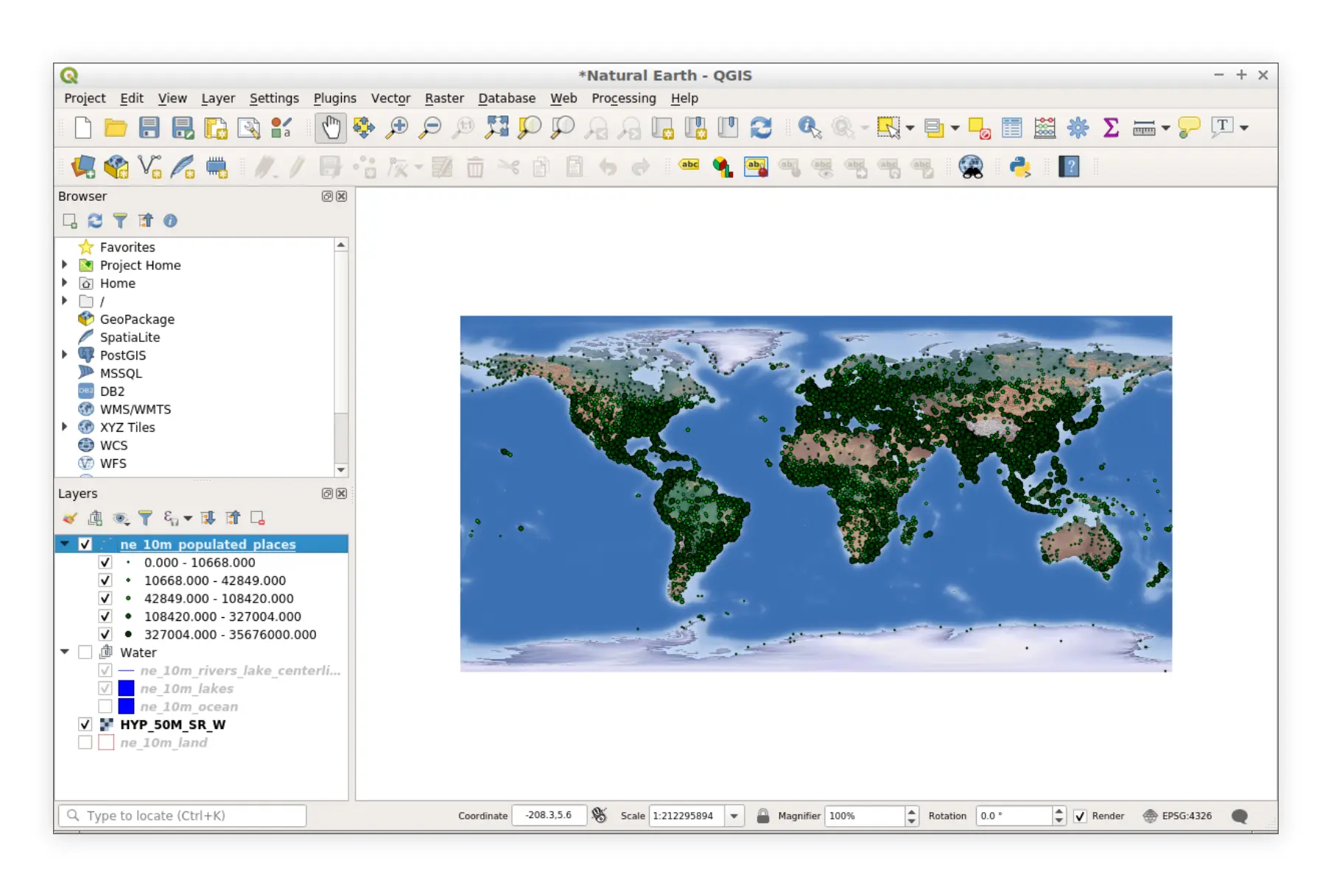
QGIS’s setup stage already adds a layer of complexity for users unfamiliar with desktop GIS software.
User Interface and Navigation
Atlas: Clean and Intuitive
Atlas’s interface is designed for non-GIS professionals. Key features are visually accessible and labeled in plain language, reducing confusion for new users.
User-friendly features:
- Guided walkthroughs for first-time users.
- Simplified menus and options.
- Tools like color pickers and drag-and-drop file uploads.
New users can create and share maps without extensive training, making Atlas a popular choice for teams with diverse skill levels.
QGIS: Feature-Rich but Overwhelming
QGIS’s interface is built for flexibility and power, which can overwhelm new users. With numerous toolbars, menus, and layers of functionality, beginners may struggle to find the tools they need.
Common challenges in QGIS:
- Understanding GIS-specific terminology.
- Learning which tools to use for basic tasks.
- Configuring the workspace to fit specific needs.
While QGIS provides extensive capabilities, these features require significant exploration and training to use effectively.
Learning Curve for Map Creation
Atlas: Minimal Learning Curve
Atlas is ideal for beginners, as it requires little to no prior training to produce professional maps. Users can:
- Import data and start mapping with step-by-step prompts.
- Style layers quickly using built-in customization options.
- Share or embed maps effortlessly with no technical expertise needed.
Atlas’s simplicity ensures that first-time users can create maps in minutes.
QGIS: Steep Learning Curve
QGIS offers unparalleled customization and advanced tools, but this power comes at the cost of a steeper learning curve. Beginners often need to:
- Invest time in tutorials or online courses.
- Refer to community forums for guidance.
- Experiment with tools to understand their functionality.
While experienced users can leverage QGIS’s power, beginners may find it time-intensive to achieve basic map creation tasks.
Training Resources
Atlas: Built-In Support
Atlas offers a range of resources to help users get started quickly:
- Interactive Tutorials: Step-by-step guides within the platform.
- Documentation: Concise and easy-to-follow instructions.
- Customer Support: Available for paid plans to provide personalized assistance.
Atlas prioritizes accessibility, ensuring that users can find help when they need it.
QGIS: Community-Driven Learning
QGIS has a robust open-source community that provides extensive learning materials:
- Online Tutorials: Free guides and videos from the QGIS community.
- Forums and FAQs: A large user base that helps troubleshoot issues.
- Books and Training Courses: Comprehensive resources for advanced learning.
While these resources are abundant, they require more time and effort to navigate than Atlas’s built-in support system.
Map Sharing and Collaboration
Atlas: Designed for Teams
Atlas integrates sharing and collaboration into the map-making process. Users can:
- Share maps via links with no additional setup.
- Invite team members to collaborate in real time.
- Embed maps on websites with no coding knowledge required.
This simplicity ensures that teams can collaborate effectively without additional training.
QGIS: Manual Sharing
In QGIS, sharing maps requires exporting them as static files or data formats. Team collaboration often involves:
- Emailing files back and forth.
- Using cloud storage services for version control.
- Relying on plugins for dynamic sharing features.
These workflows can be cumbersome and require additional knowledge of external tools.
Suitable Use Cases for Beginners
Atlas: Perfect for First-Time GIS Users
Atlas is ideal for:
- Teams with limited GIS experience who need fast results.
- Professionals creating maps for presentations or business purposes.
- Beginners looking for a stress-free introduction to GIS.
QGIS: Best for Technical Users
QGIS works well for:
- Advanced GIS users comfortable with technical tools.
- Projects requiring extensive geospatial analysis or customizations.
- Teams with time to invest in learning and mastering the platform.
Final Thoughts: Which Platform Requires Less Training?
| Feature | Atlas | QGIS |
|---|---|---|
| Setup | Browser-based, no installation needed | Requires download and installation |
| Ease of Use | Intuitive, beginner-friendly interface | Complex, feature-packed interface |
| Learning Curve | Minimal, guided tutorials included | Steep, requires time and exploration |
| Collaboration | Real-time sharing and editing | Manual file sharing workflows |
| Training Resources | Built-in tutorials and support | Community-driven, abundant but scattered |
Choose Atlas If:
- You want to create maps quickly with little to no prior experience.
- Your team values simplicity and collaborative workflows.
- You need an intuitive tool that works right out of the box.
Choose QGIS If:
- You are comfortable investing time in learning complex tools.
- Your projects require advanced geospatial analysis and customization.
- You have prior GIS experience or technical support available.
Both platforms have their strengths, but if easy map creation with minimal training is your priority, Atlas is the clear winner. QGIS, on the other hand, is perfect for those who need advanced capabilities and are willing to invest the time to master them.

