OpenStreetMap (OSM) is a powerful source of free geospatial data, providing detailed information on roads, buildings, land use, and more. Querying OSM data in QGIS allows you to extract specific features, analyze spatial data, and integrate it into your GIS workflows.
This guide walks you through querying OSM data in QGIS.
Why Query OSM Data?
OSM data is invaluable for projects in urban planning, transportation, environmental analysis, and more. By querying OSM, you can:
- Extract specific features, like roads, schools, or rivers.
- Perform geospatial analysis on global or local datasets.
- Create detailed maps tailored to your project needs.
Querying OSM Data in QGIS: Step-by-Step
Step 1: Install the QuickOSM Plugin
- Open QGIS and navigate to Plugins > Manage and Install Plugins.
- Search for QuickOSM in the plugin manager.
- Click Install Plugin to add it to your QGIS installation.
QuickOSM simplifies the process of querying and downloading OSM data directly in QGIS.
Step 2: Open the QuickOSM Tool
- Go to the Vector menu and select QuickOSM > QuickOSM.
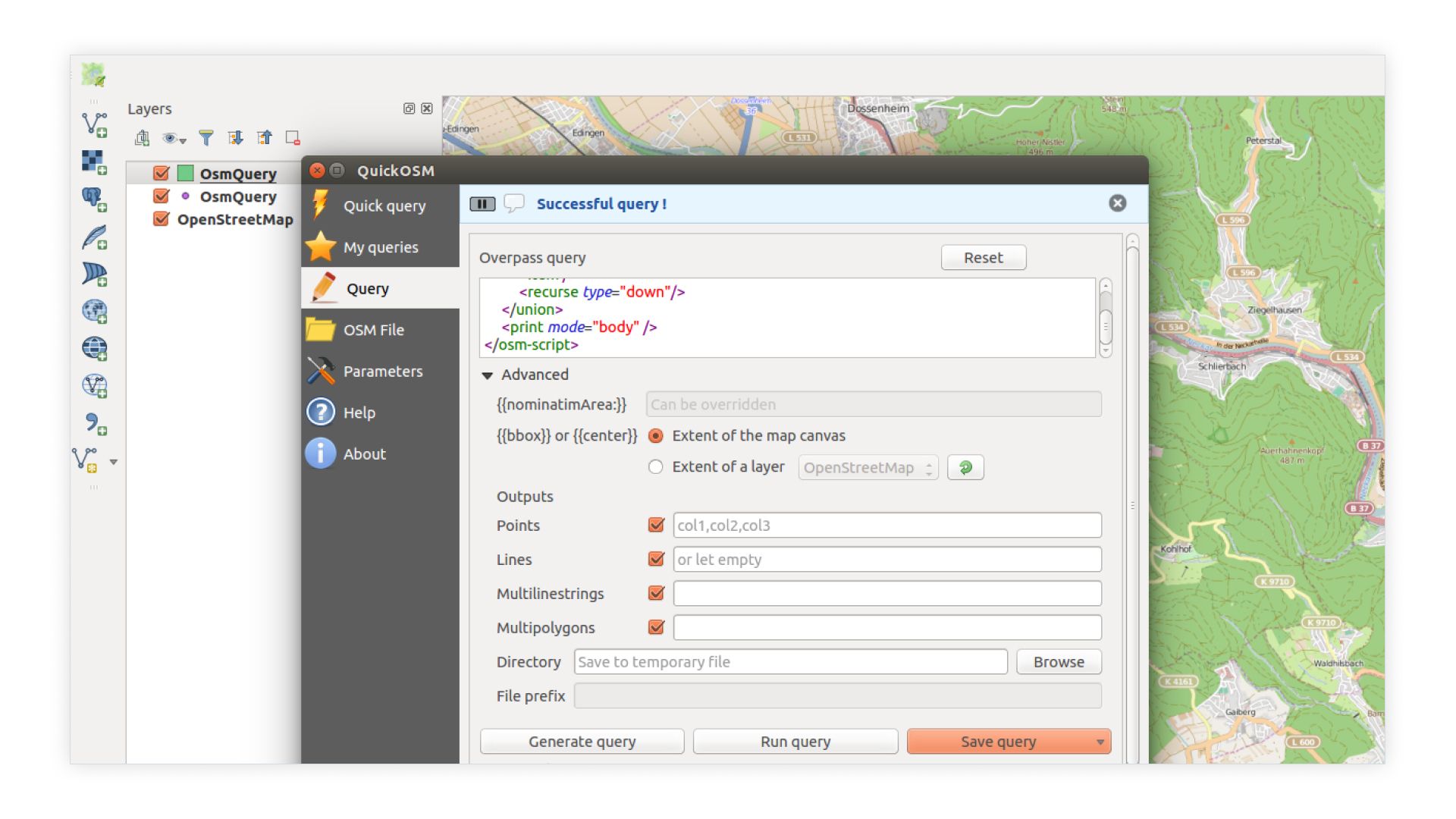
- The QuickOSM dialog box will appear, allowing you to define your query.

Step 3: Define Your Query
- Key: Enter the type of feature you want to query. Common examples include:
highwayfor roads.buildingfor structures.landusefor land classifications.
- Value: Specify the feature you need. For instance:
primaryfor primary roads.residentialfor residential buildings.forestfor forested areas.
- Extent: Define the geographical area for your query. Options include:
- Current map canvas.
- A manually specified bounding box.
- Predefined areas (e.g., city or country).
Step 4: Run the Query
- Click Run to execute your query.
- QuickOSM will fetch the data from OSM and display it as a new layer in your QGIS project.
Step 5: Style and Analyze the Data
- Use QGIS’s symbology tools to style the data (e.g., color roads by type or size buildings by height).
- Perform spatial analyses, such as proximity calculations or density mapping, using QGIS’s processing toolbox.
Limitations of Querying OSM Data in QGIS
While QGIS and QuickOSM are powerful, there are some limitations:
- Learning Curve: Beginners may find the setup and configuration of queries challenging.
- Data Size Limits: Large queries can overwhelm QuickOSM or cause performance issues.
- Manual Updates: OSM data in QGIS is static unless re-downloaded, requiring manual updates for the latest information.
Querying OSM Data in Atlas: A Simpler Alternative
If you’re looking for an easier way to query OSM data, Atlas offers a more user-friendly approach. Atlas integrates OSM data seamlessly, allowing users to query and visualize features without needing plugins or advanced configurations.
How to Query OSM Data in Atlas
- Log in to Atlas: Open your browser, log in, and start a new map project.
- Navigate to the OSM Integration: In the right sidepanel you'll find the OpenStreetMap Integration.
- Select Area: Choose the area you want to query data for (map extent is default).
- Query Features: Query specific features, such as roads, parks, or water bodies, in just a few clicks.
- Share Instantly: Embed your map or share it with teammates using a link—no additional downloads or exports required.
Why Choose Atlas for OSM Queries?
- No Plugins Required: Everything is built-in and ready to use.
- Beginner-Friendly: Designed for users of all skill levels.
- Real-Time Collaboration: Work with your team on live maps, without version conflicts.
- Cloud-Based: Accessible from any device, without installation or hardware constraints.
Final Thoughts
Querying OSM data in QGIS is a powerful way to access detailed geospatial information, but it requires some setup and technical knowledge. For those comfortable with QGIS’s tools, QuickOSM provides robust querying capabilities.
However, if you’re seeking a simpler, more intuitive option, Atlas is the way to go. Its seamless integration of OSM data, ease of use, and collaborative features make it an excellent choice for teams and individuals alike. Try Atlas for free to experience effortless OSM queries and map creation.


