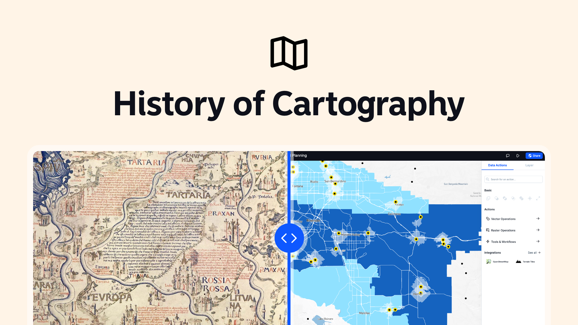
Maps have been a crucial part of human civilization for thousands of years.
They help us understand our world, navigate it, and make sense of our place within it. The history of cartography, or mapmaking, is a fascinating journey that reflects human ingenuity, exploration, and technological advancement.
Let’s explore this rich history and see how cartography has evolved over time.
Ancient Cartography
Early Maps
The earliest known maps date back to around 2300 BC. These ancient maps were often simple, depicting local areas and features important to the people who created them.
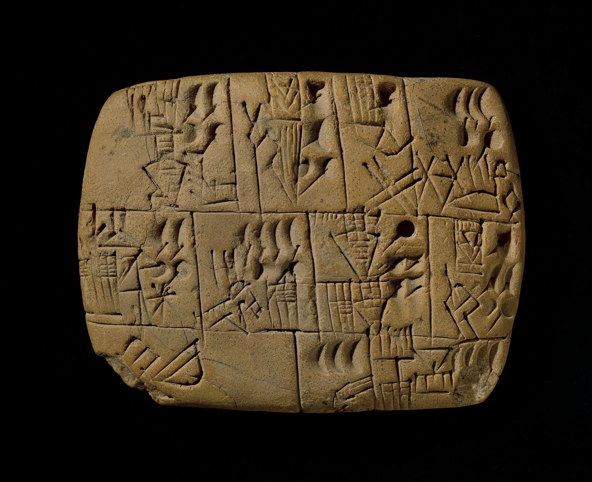
For example, the Babylonians etched maps on clay tablets. These maps were primarily used for practical purposes, such as delineating land boundaries and planning agriculture.
Greek and Roman Contributions
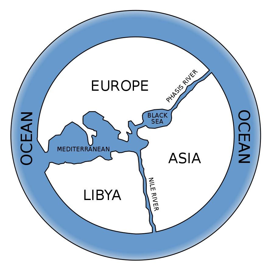
The Greeks and Romans made significant advancements in cartography. The Greek philosopher Anaximander is often credited with creating one of the earliest world maps around 600 BC. His map depicted the known world as a circular disk surrounded by oceans.
Claudius Ptolemy, a Greek-Egyptian scholar, made a monumental contribution in the 2nd century AD with his work "Geographia." Ptolemy’s maps included detailed descriptions and coordinates for thousands of places, introducing the concepts of latitude and longitude.
Medieval Cartography
Mappa Mundi
During the medieval period, European maps, known as "mappa mundi," were often religious and symbolic rather than practical. These maps depicted the world as known through religious texts, with Jerusalem typically at the center.
The Hereford Mappa Mundi, created around 1300 AD, is a famous example. It illustrates the known world in intricate detail, blending geographical knowledge with mythological and religious elements.
Islamic Contributions
Meanwhile, in the Islamic world, cartography flourished. Scholars like Al-Idrisi created highly accurate maps based on extensive travel and the study of earlier Greek and Roman works.
Al-Idrisi’s "Tabula Rogeriana," completed in 1154 AD, was one of the most advanced maps of its time, depicting Europe, Asia, and North Africa with remarkable precision.
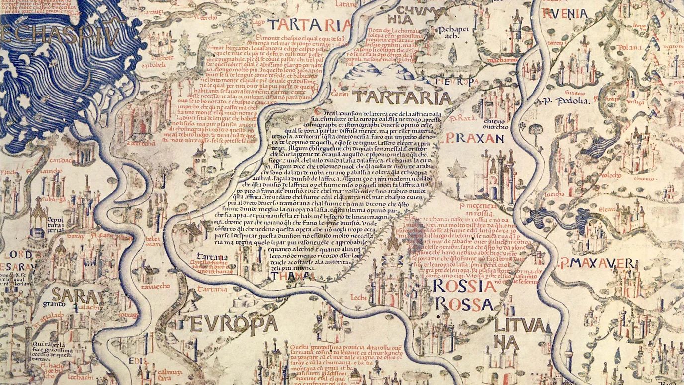
Renaissance and the Age of Exploration
Printing Revolution
The invention of the printing press in the mid-15th century revolutionized cartography. Maps could now be reproduced and distributed widely, increasing their accessibility and standardizing geographical knowledge.
Exploration and New Discoveries
The Age of Exploration brought about significant changes in cartography. Explorers like Christopher Columbus and Vasco da Gama discovered new lands, expanding the known world and challenging existing maps.
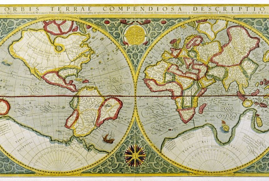
Gerardus Mercator, a Flemish cartographer, made a breakthrough in 1569 with his Mercator projection. This cylindrical map projection allowed for accurate navigation by preserving angles, making it invaluable for sea travel.
Modern Cartography
Advancements in Accuracy
The 18th and 19th centuries saw continued advancements in map accuracy. Triangulation, a method of determining distances and positions using geometry, became widely used.
John Harrison’s invention of the marine chronometer in the 18th century allowed for precise longitude measurements at sea, further enhancing the accuracy of maps.
Thematic Maps
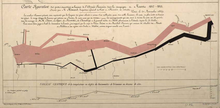
The 19th century also saw the rise of thematic maps, which depict specific themes or data, such as population density, weather patterns, or economic activity. Charles Joseph Minard’s 1869 map of Napoleon’s Russian campaign is a famous example, combining geographical information with statistical data to tell a powerful story.
20th Century and Digital Revolution
Aerial Photography and Satellite Imagery
The 20th century brought about revolutionary changes in cartography with the advent of aerial photography and satellite imagery. These technologies allowed for highly detailed and accurate maps of even the most remote areas.
The launch of satellites like Landsat in the 1970s provided continuous, real-time data on the Earth’s surface, revolutionizing mapmaking and geographic analysis.
Geographic Information Systems (GIS)
The development of Geographic Information Systems (GIS) in the late 20th century transformed cartography. GIS allows for the storage, analysis, and visualization of spatial data, enabling the creation of dynamic and interactive maps.
Platforms like Atlas, a browser-based GIS tool, have made it easier than ever to create, share, and analyze maps. These systems integrate various data sources, providing powerful tools for decision-making and scientific research.
The Future of Cartography
Interactive and Real-Time Maps
Today, maps are more interactive and accessible than ever. Digital maps on our smartphones provide real-time navigation and traffic updates. Online platforms allow users to create and share custom maps with ease.
3D and Augmented Reality
Advancements in technology are pushing the boundaries of cartography even further. 3D mapping and augmented reality (AR) provide immersive experiences, allowing users to explore environments in new ways. These technologies are being used in fields ranging from urban planning to gaming.
Big Data and AI
Big data and artificial intelligence (AI) are also shaping the future of cartography. These technologies enable the analysis of massive datasets, uncovering patterns and insights that were previously impossible to detect. AI algorithms can process and visualize data quickly, making maps more informative and useful.
The history of cartography is a testament to human curiosity and ingenuity. From ancient clay tablets to sophisticated digital platforms, maps have evolved alongside our understanding of the world.
Today, tools like Atlas make it easier than ever to create and analyze maps, continuing the tradition of innovation in cartography. As technology advances, the ways we map and understand our world will continue to evolve, opening up new possibilities for exploration and discovery.


