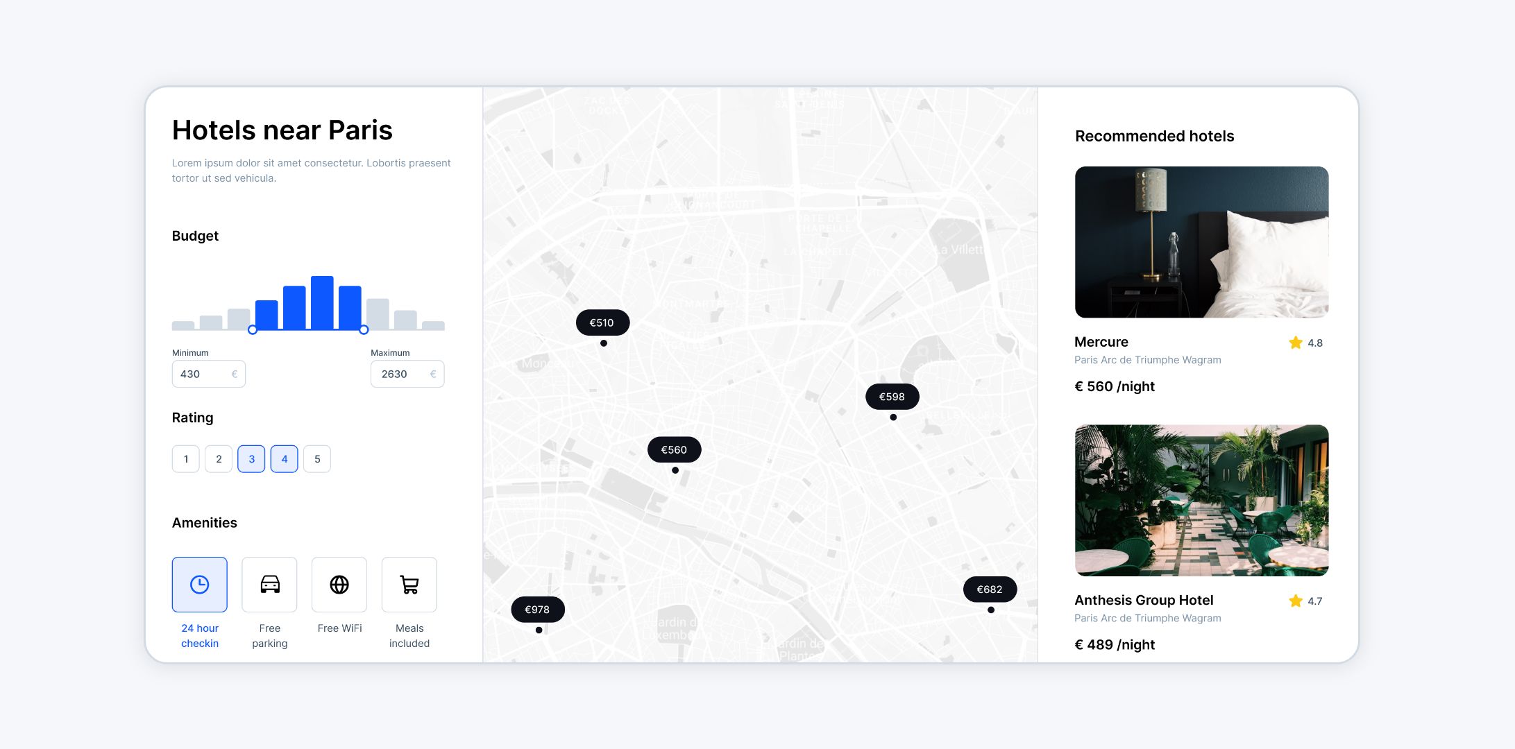
Creating interactive maps used to be a task reserved for GIS professionals with advanced technical skills.
Today, the landscape has changed dramatically.
Easy-to-use map builders like Atlas have made it possible for anyone — from educators to business analysts — to design interactive, professional maps without needing a background in coding or GIS.
This article explores how to build interactive maps using a modern map builder and highlights the benefits of these tools.
Why Interactive Maps Matter
Interactive maps offer more than static visuals. They allow users to explore data dynamically, uncovering patterns and insights that might otherwise go unnoticed. Whether you're visualizing customer demographics or planning a new city layout, interactive maps make the data more engaging and actionable.
Key Features of Interactive Maps:
- Dynamic Layers: Show or hide data layers to focus on specific details.
- Clickable Elements: Add pop-ups to display additional information.
- Filters and Search: Let users filter data by categories or search for specific locations.
Interactive maps turn data into a story, making them an essential tool across industries.
Getting Started with a Map Builder
Modern map builders like Atlas make creating interactive maps straightforward. Here’s how to get started.
1. Gather Your Data
Before you begin, ensure you have the data you want to map. This could include:
- Points (e.g., store locations, landmarks).
- Lines (e.g., roads, pipelines).
- Polygons (e.g., city boundaries, service areas).
Most map builders support common file formats like CSV, KML, and GeoJSON.
2. Choose Your Platform
Select a platform that suits your needs. Atlas is an excellent option for beginners and professionals alike, offering a clean interface and powerful features.
Step-by-Step Guide to Building an Interactive Map
Here’s how to create an interactive map using a builder like Atlas.
Step 1: Log In or Sign Up
Start by logging into your account or signing up for free. Browser-based tools like Atlas require no installation, so you can begin right away.
Step 2: Upload Your Data
- Navigate to the "Add Data" section.
- Upload your dataset. Most platforms will automatically process and display the data on the map.
- Check for errors and verify that the data is accurate.
Step 3: Style Your Map
Customize the appearance of your map to make it clear and visually appealing.
- Choose a Basemap: Select a style that suits your project, such as satellite imagery or street view.
- Layer Styling: Adjust the color, size, and labels for your data points, lines, or polygons.
- Legend and Labels: Add a legend to explain the map’s features and use labels for context.
Step 4: Add Interactivity
Interactivity is where the magic happens:
- Pop-Ups: Configure pop-ups to show details when users click on a map element.
Step 5: Build your Interface
Activate Builder Mode and use Atlas' flexible builder where you can drag-and-drop components and sections to the map to create your own map applications.
- Filters: Enable filters to let users refine the data displayed.
- Title and Description: Give the end user information about the map.
- Feature List: Display a list of the filtered features in the map.
Step 6: Share Your Map
Once your map is ready, share it with your audience:
- Link Sharing: Share a direct link to the map.
- Embed Code: Embed the map on your website or blog.
- Export Options: Download the map as an image or PDF for offline use.
Advantages of Using an Easy-to-Use Map Builder
1. No Technical Expertise Required
Map builders like Atlas are designed for everyone, not just GIS professionals. The drag-and-drop interface makes it accessible even for first-time users.
2. Saves Time
Interactive maps that used to take days or weeks can now be created in hours. This speed is crucial for teams working on tight deadlines.
3. Customizable Designs
Every project is different. Modern map builders let you customize maps to match your specific needs, whether it’s a real estate directory, a logistics tracker, or a community project.
4. Real-Time Collaboration
Collaborate with your team in real-time. Multiple users can edit and update maps simultaneously, ensuring everyone is on the same page.
5. Integration with Other Tools
Many map builders integrate seamlessly with other software, allowing you to pull in data or export results for further analysis.
Practical Applications
Interactive maps are incredibly versatile. Here are some ways they’re used across industries:
Urban Planning
Planners can create zoning maps or analyze traffic patterns to improve city layouts.
Environmental Monitoring
Track changes in land use or visualize the impact of climate change with dynamic maps.
Retail and Marketing
Use interactive maps to analyze customer locations and optimize store placements.
Education
Teachers and students can collaborate on geography projects, creating maps that illustrate historical events or environmental changes.
Why Choose Atlas for Your Interactive Maps
Atlas stands out as a map builder for several reasons:
- Ease of Use: Drag-and-drop tools make map creation simple.
- Robust Features: From heatmaps to real-time collaboration, Atlas offers advanced functionality.
- Browser-Based: No downloads or installations needed.
- Affordable Plans: Free options make it accessible for small teams and individuals.
Atlas combines simplicity with power, enabling anyone to create professional, interactive maps.
Interactive maps are no longer a luxury reserved for tech experts. With tools like Atlas, anyone can turn data into compelling visualizations. Whether you’re presenting research, planning a project, or sharing information with the public, a map builder makes it easy to bring your ideas to life.
So why wait? Dive into a map builder and start creating today.


