

When choosing a GIS platform, understanding the features each tool offers is crucial. Atlas and QGIS are two popular options, each catering to different needs. Atlas is a modern, browser-based GIS tool built for simplicity and collaboration, while QGIS is a feature-rich, open-source desktop application.
This article compares their key features to help you decide which platform best fits your needs.
Introducing Atlas and QGIS
What is Atlas?
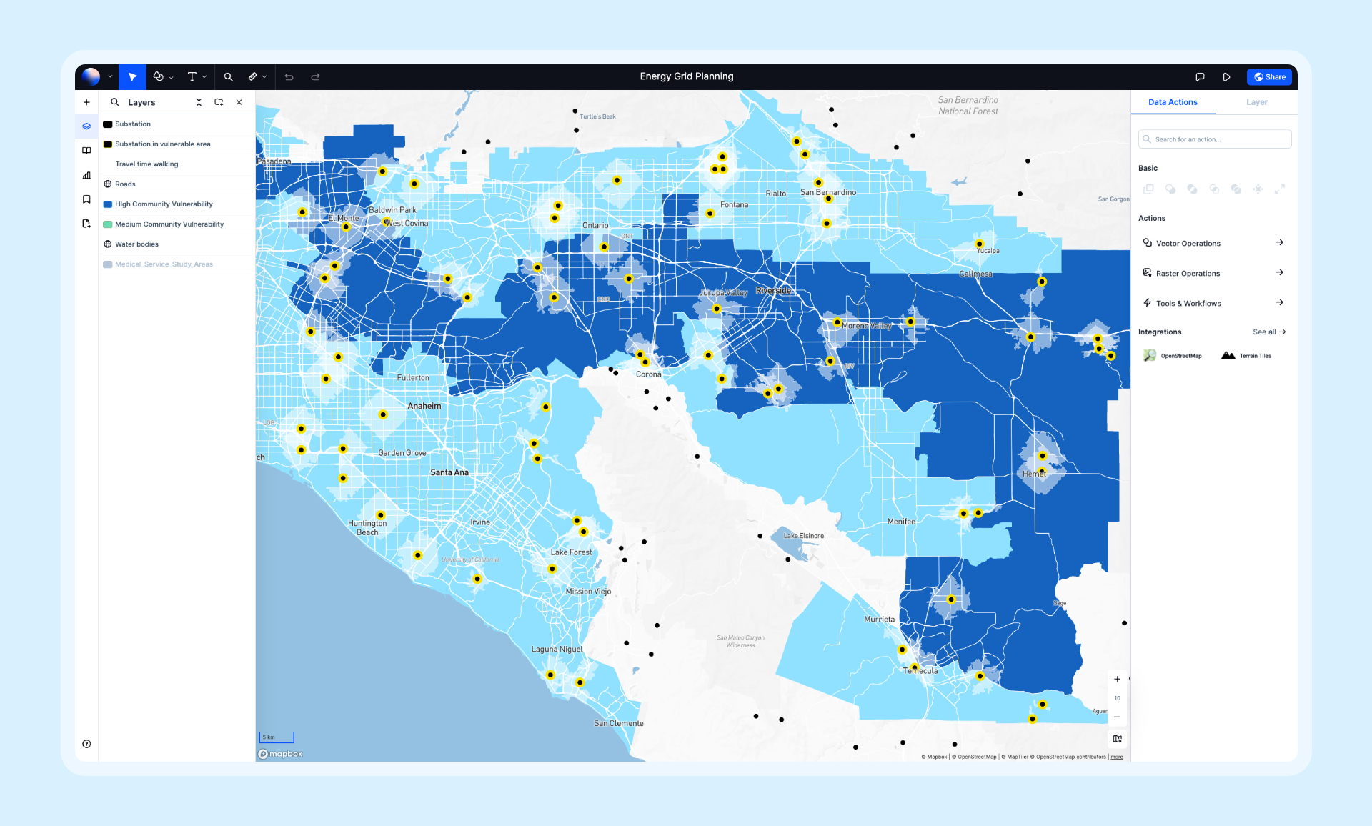
Atlas is a browser-based GIS platform designed for simplicity, collaboration, and accessibility. It’s built to help teams and individuals quickly create, analyze, and share interactive maps without requiring advanced technical skills. Atlas is especially popular among beginners and collaborative teams, thanks to its intuitive interface and real-time collaboration features.
What is QGIS?
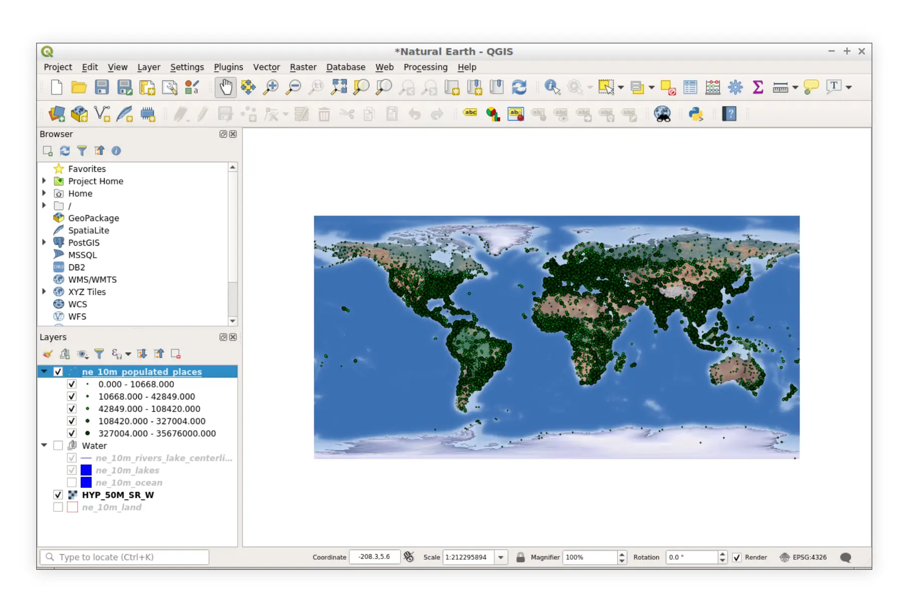
QGIS (Quantum GIS) is an open-source, desktop GIS application known for its powerful geospatial analysis capabilities. It offers an extensive range of tools for map creation, spatial analysis, and data visualization. While QGIS is free to use, its advanced features come with a steeper learning curve, making it more suited for GIS professionals and technical users.
Quick Comparison Table: Atlas vs. QGIS
| Feature | Atlas | QGIS |
|---|---|---|
| Platform | Browser-based, no installation required | Desktop-based, requires installation |
| Ease of Use | Intuitive, beginner-friendly | Steeper learning curve for beginners |
| Collaboration | Real-time, cloud-based collaboration | File-based, manual sharing |
| Data Import Formats | Supports major geo formats (CSV, GeoJSON) | Extensive format support, including Shapefiles |
| Styling and Customization | User-friendly, pre-built templates | Advanced but requires manual setup |
| Spatial Analysis | Core analysis tools (buffers, heatmaps) | Comprehensive, advanced analysis options |
| Interactivity | Interactive maps with zero coding | Requires plugins or custom scripting |
| Cost | Freemium (free with paid tiers) | Free, open-source |
Platform and Accessibility
Atlas: Browser-Based Convenience
Atlas works directly in your web browser, eliminating the need for installations. It’s compatible with any device connected to the internet, making it an excellent choice for teams working across different platforms.
- Pro: No setup required; works on all devices.
- Con: Requires internet access for optimal functionality.
QGIS: Desktop Application
QGIS is a desktop-based GIS tool. While it’s available for free, users need to download and install it. This makes it less accessible for teams with varied devices or users with limited technical expertise.
- Pro: Works offline once installed.
- Con: Requires installation and sufficient device storage.
Which to Choose? If accessibility and ease of setup are priorities, Atlas is the better option.
Ease of Use
Atlas: Designed for Simplicity
Atlas is built for users of all skill levels. Its interface is clean, with drag-and-drop functionality and pre-built templates. Beginners can start creating maps with minimal training.
QGIS: Powerful but Complex
QGIS offers extensive capabilities but comes with a steeper learning curve. The interface can feel overwhelming for first-time users, especially without prior GIS experience.
Which to Choose? For a quick start and simplicity, Atlas wins. QGIS is better suited for users willing to invest time in mastering the tool.
Collaboration and Sharing
Atlas: Real-Time Collaboration
Atlas’s cloud-based model allows multiple users to edit maps simultaneously, making it ideal for team projects. Maps can be shared with a link or embedded into other platforms, making sharing seamless.
QGIS: File-Based Sharing
QGIS relies on exporting and sharing files. This manual process can lead to version control issues and is less efficient for collaborative teams.
Which to Choose? Atlas excels in collaboration, especially for remote or distributed teams.
Styling and Customization
Atlas: Quick and Easy
Atlas simplifies map styling with pre-configured templates and user-friendly tools. Beginners can customize maps without diving into complex settings.
QGIS: Highly Customizable
QGIS offers advanced customization options for users who need specific designs. However, these features often require detailed knowledge of GIS styling techniques.
Which to Choose? For straightforward customization, Atlas is better. Advanced users may prefer QGIS for its flexibility.
Spatial Analysis Tools
Atlas: Core Analysis Features
Atlas includes key tools like:
- Buffers: Analyze distances around features.
- Heatmaps: Visualize density and hotspots.
- Points-in-Polygon Analysis: Count features within specific areas.
These tools are easy to use, making Atlas great for basic spatial analysis.
QGIS: Comprehensive Analysis
QGIS offers advanced spatial analysis tools, including:
- Geoprocessing: Perform tasks like clipping, merging, and intersecting layers.
- 3D Analysis: Visualize data in three dimensions.
- Plugins: Extend functionality for specific use cases.
Which to Choose? For basic analysis, Atlas is sufficient. QGIS is ideal for in-depth geospatial analysis.
Interactivity and Applications
Atlas: Interactive Maps Made Simple
Atlas enables users to create interactive maps without any coding. You can embed maps on websites or dashboards, adding clickable elements and pop-ups with ease.
QGIS: Requires Advanced Knowledge
Interactive maps in QGIS typically require plugins or custom scripting. This makes it less beginner-friendly for creating interactive applications.
Which to Choose? For quick interactive maps, Atlas is the better choice.
Cost
Atlas: Freemium Model
Atlas offers a free tier with essential features, making it accessible for individuals and small teams. Paid plans unlock advanced features and are budget-friendly.
QGIS: Completely Free
QGIS is open-source and free for all users. However, the cost of training or hiring experts to utilize its full potential may add to the overall expense.
Which to Choose? For completely free software, QGIS is unbeatable. Atlas’s free plan is sufficient for many use cases, with affordable upgrades available.
Final Thoughts: Which Tool Fits Your Needs?
Choose Atlas if you:
- Want a tool that is easy to set up and use.
- Need real-time collaboration and cloud-based sharing.
- Prefer a browser-based solution for accessibility.
Choose QGIS if you:
- Require advanced geospatial analysis and customization.
- Are comfortable with desktop applications and technical workflows.
- Need a completely free, open-source tool with no subscription fees.
Both platforms have their strengths. For teams prioritizing collaboration and simplicity, Atlas is the go-to option. If you’re an advanced user needing in-depth analysis tools, QGIS might be the right choice.
For a concise feature checklist and FAQs, see the QGIS alternative page on Atlas.


