The Mercator Projection may sound like a fancy term from an old dusty geography textbook, but it is in fact a vital element of our everyday lives. While it may have receded into the background of our physical atlases, the era of digital mapping has given it a fresh burst of life.
But what is the Mercator projection, and why is it the preferred choice for web mapping? That's exactly what we're going to explore in this article. Let's dive into this unstated hero of modern navigation and its continued relevance in our digital world.
The story of Mercator Projection
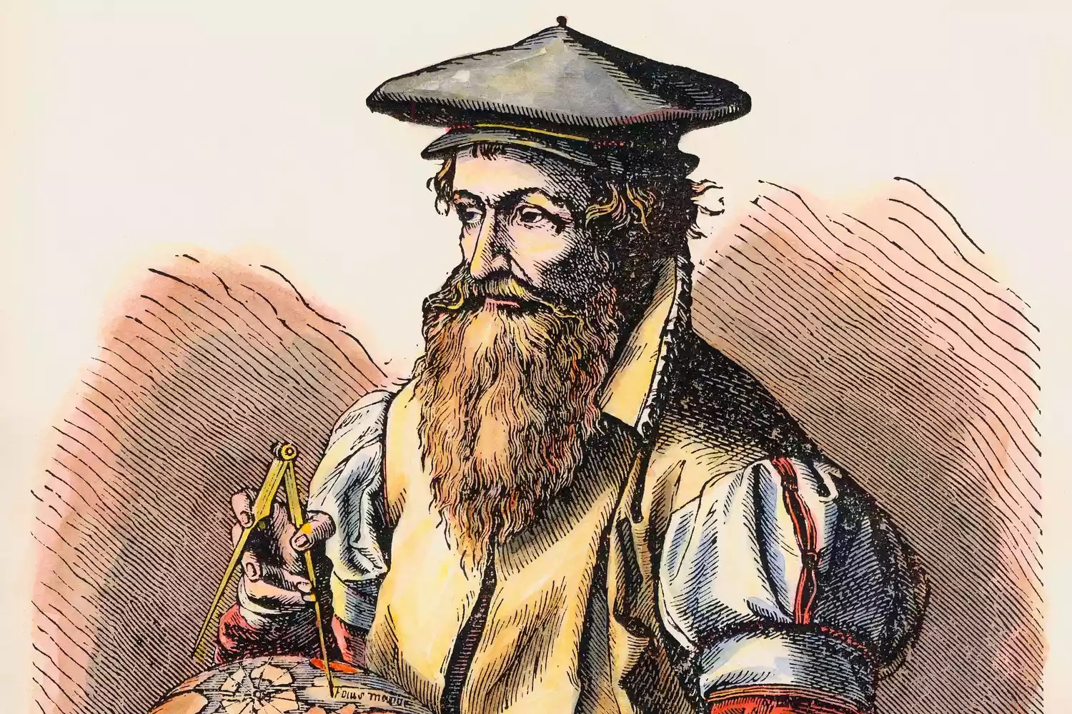
Let’s travel back to 1569 and meet Gerardus Mercator, a mapmaker! He's been trying to solve a problem sailors have - navigating a round globe using a flat map. His solution to this problem is the Mercator projection.
This projection enables him to draw the round world on a massive flat map. It's 202 by 124 cm and spread across 18 sheets. He calls this groundbreaking creation Nova et Aucta Terrae Desciptio ad Usum Navigantium Emendata. It translates to "A new and improved map of the Earth corrected for sailors."
Now, sailors could draw a straight line on their map, which represents their pathway on Earth's surface. The Mercator map gives accurate directions, so sailors know “up” is north and “down” is south. Plus, it keeps landforms' shapes pretty accurate, which is super important for navigation.
The Mercator projection quickly became standard - the major leagues for navigation maps. Its true-to-direction approach was an outstanding innovation in an era when sea exploration was opening new frontiers. Today, even though we've traded compasses for GPS, the legacy of Mercator's big idea still shapes our understanding of the world.
What is the Mercator projection?
The Mercator projection, like all map projections, is a method of showcasing our three-dimensional Earth on a two-dimensional surface - a flat map.
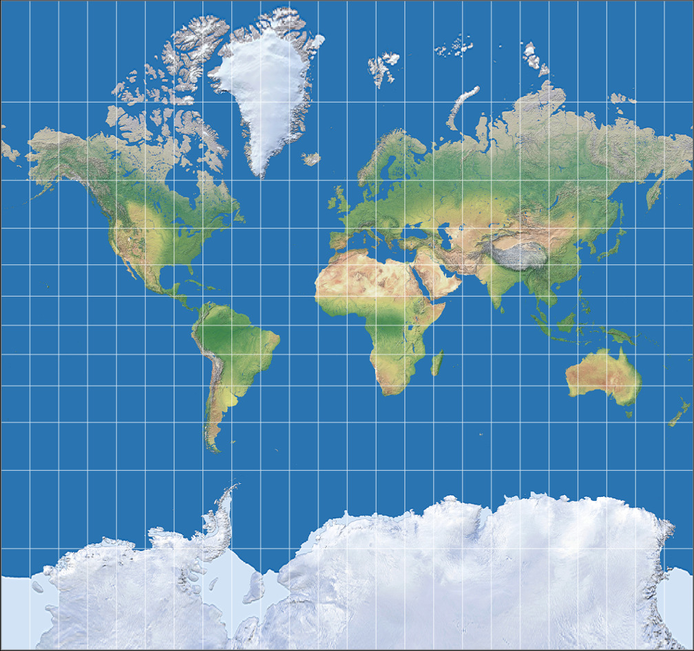
Imagine you have a lightbulb inside a globe and a big piece of paper wrapped around it. As you shine a light from the center, the countries would cast shadows onto the paper. If you unroll this paper, you'd essentially have a Mercator projection map!
Sounds simple, right? But the genius lies in the way it handles angles. The magic of the Mercator projection is that it preserves all the angles. That means, if two streets intersect at a 90-degree angle on the map, they also do so in real life! This property is called 'conformality'.
However, while angles remain true, Mercator projection compromises on the size of countries, especially as we move away from the equator. The further from the equator, the bigger countries appear on the map. That's why on many maps, Greenland looks similar to Africa, Alaska similar to Australia, and Antarctica looks like a big frozen wasteland!
The Mercator projection balances the delicate act of making a round Earth fit on a flat map while keeping the geometry on point. The result is a map useful for many navigational and digital applications, which we'll dive into next.
Why is Mercator Projection So Important?
Historically, the Mercator projection laid the groundwork for exploration. If we wind the clock back 400 years, sailors in the vast oceans relied on this very technique. Why? Well, without any landmarks to follow, captains needed a reliable way to navigate and maintain their courses over long distances. The Mercator made this possible. It allowed sailors to draw a straight line from start to finish and sail along that path. This aspect made an explorer's journey across unfamiliar waters a lot less unpredictable.
Fast forward to today, the Mercator projection is still incredibly relevant, although its use has evolved. Now, it has found a new home in the world of digital mapping. Online mapping services like Google Maps, Bing Maps, and Mapbox use this projection because of its unique characteristics. Its ability to maintain accurate angles helps provide consistent maps at all zoom levels. When you zoom in or out on a digital map, its the Mercator projection working behind the scenes that maintains the true shape and angles of roads, coastlines, and buildings.
Despite its downside - distortion of size near the poles, the Mercator's ability to maintain accurate directions and shapes is still its big selling point. It’s a trade-off that has proven successful for many forms of navigation, from historical sea voyages to today’s digital map searches. So even after centuries, the Mercator projection still plays a crucial role in how we explore and understand our planet.
Debate Around the Mercator Projection
Now, while the Mercator projection sounds pretty neat, it's not without its critics. After all, when it comes to representing our round world on a flat surface, something's got to give, right?
The issue at the centre of this debate is "distortion". What does distortion mean? Well, in this case, it's about the Mercator projection making places, particularly countries far from the equator, look way bigger than they really are. That's why Greenland can look as big as Africa on some maps, even though in reality, Africa is about 14 times bigger (whoa)!
And it's not just about size—the exaggeration can also affect how we see population and resources. Countries closer to the poles seem to have more space on the map than they actually do, while places nearer to the equator can appear smaller. And this can sometimes give us a wrong impression about different parts of our world.
Another criticism is its Eurocentric bias.. Because Europe is towards the top of the map, it appears larger than it really is, which can favour a more European-centred view of the world.
But it's important to remember that every map projection—including the Mercator—has its pros and cons. While researchers and cartographers continue to develop new mapping techniques, the debate around the use of the Mercator projection and its distortions continues to be a hot topic of discussion in the world of cartography.
The Future of the Mercator Projection
Beyond the clear blue sky of today's attractive web mapping lies a sea of uncertainty for the future of the Mercator projection. One thing's for sure: its Atlases era is fading. For educators and geographers, its distorted portrayal of country sizes is a deal-breaker. They've switched to other projections, like the Robinson or Winkel Tripel, which they feel give a more balanced view of the world.
Now, with its cheering crowd coming mainly from digital mapping services, can the Mercator projection continue to hold its popularity? That's the million-dollar question. Right now, it seems so. Its ability to keep angles, directions, and shapes correct is so helpful for our zoomable online maps that it appears unbeatable. But is its time running out?
Emerging technologies and changing priorities could challenge its position. As we grow more conscious about representations and balances of power, might there be a push towards more 'fair' and less 'Eurocentric' map projections? Plus, as technology evolves, new ways of displaying geographical data might appear. Perhaps, 3D virtual representations could become more common, diminishing the need for 'flat' map projections.
Yet, given its considerable usefulness in navigation and digital map platforms, it seems unlikely that the Mercator projection would just vanish. It might take a lesser role or adapt to fit new technologies, but will likely maintain a presence in our spatial understanding. From a simple cartographer's tool to a digital giant, no matter what happens, the Mercator projection has secured its place in the annals of geographical history.
Conclusion
Navigating through the world of cartography and map projections can be a fascinating journey. Despite some distortions and misrepresentations, the Mercator projection has played a crucial role in the evolution of geographical mapping.
Next time you navigate using a map, appreciate the magic that is the Mercator projection — the unsung hero of your journey!


