Browser-based mapping tools have transformed the way people create, view, and share geographic data. Without the need for installations or complex setups, platforms like Atlas and Google Earth (Web) make it easier than ever to map and analyze the world around us.
But how do these two browser-based tools compare? Let’s explore their capabilities in collaboration, customization, data integration, and usability.
Comparison at a Glance
| Feature | Atlas | Google Earth (Web) |
|---|---|---|
| Collaboration | Real-time editing and sharing | Shareable links for static viewing |
| Custom Maps | Interactive maps with dynamic controls | Basic placemarks and 3D exploration |
| Data Integration | Multi-format uploads, real-time updates | Limited data overlay capabilities |
| Accessibility | Fully browser-based, team-ready | Browser-based, single-user focus |
1. Collaboration Features
Atlas
Atlas is built for real-time collaboration, allowing teams to:
- Work on the same map simultaneously with live updates.
- Share maps via links with role-based permissions (view, edit, or comment).
- Track changes easily, ensuring that all collaborators stay aligned.
These capabilities make Atlas ideal for projects requiring teamwork, such as urban planning or logistics management.
Google Earth (Web)
Google Earth (Web) provides basic sharing options. Users can generate links to let others view their maps or scenes, but:
- Collaboration is limited to viewing only—no simultaneous editing.
- Any map updates require re-sharing the link after changes.
While sufficient for personal projects or static presentations, Google Earth (Web) lacks the collaborative depth professionals often need.
2. Customizing Maps
Atlas
Atlas allows users to create highly customized maps, offering:
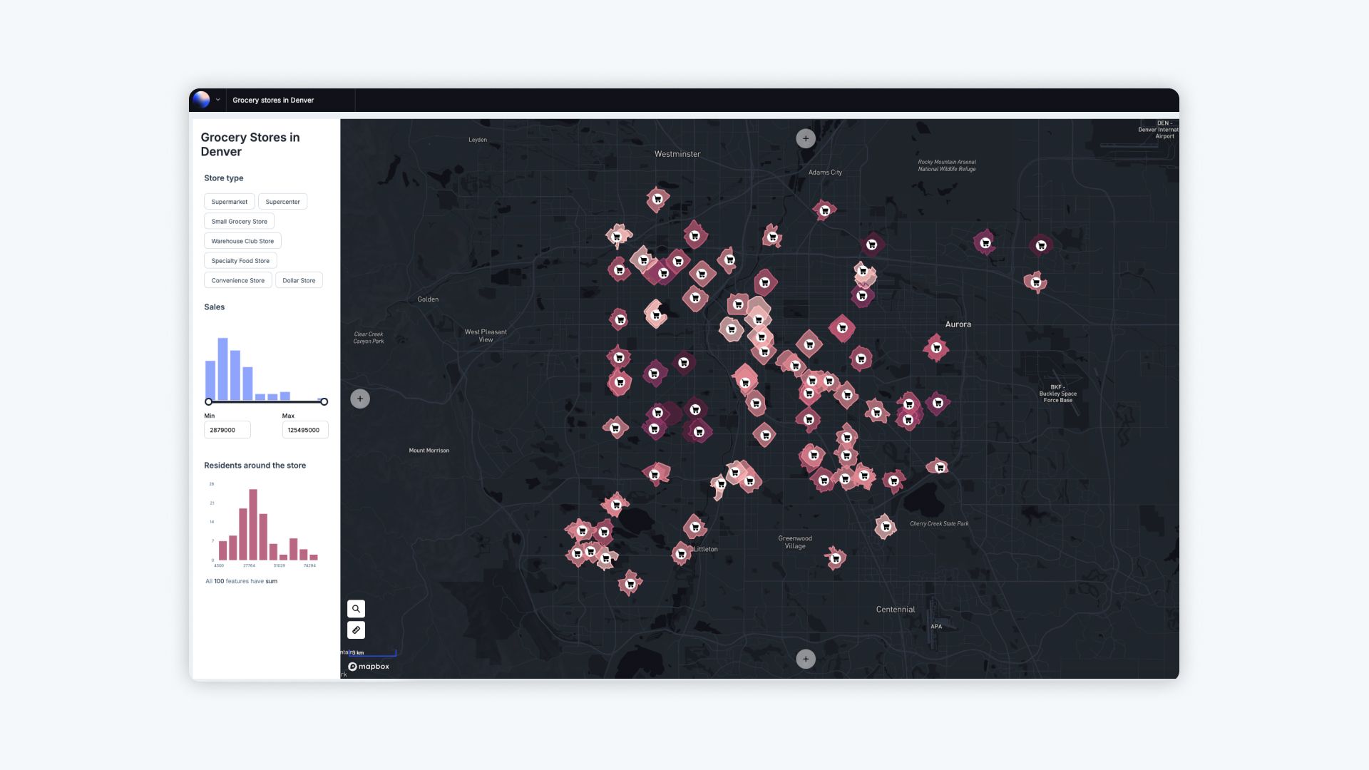
- Data-driven layers, styled by attributes like population, traffic, or revenue.
- Interactive features like filters and pop-ups to explore data dynamically.
- Builder mode for designing full-featured, embedded web applications.
These tools make Atlas a robust choice for business dashboards, zoning maps, and other professional applications where user engagement is key.

Google Earth (Web)
Google Earth (Web) focuses on visual exploration rather than customization. While users can add placemarks, paths, and polygons, customization options are limited to:
- Basic labels and annotations.
- Minimal styling for lines or points.
For professionals seeking deeper interactivity, additional tools or plugins are required.

3. Data Integration and Formats
Atlas
Atlas supports a wide range of geospatial data formats, including:
- GeoJSON, CSV, and Shapefiles for direct uploads.
- Real-time data integration via live feeds, such as traffic updates or environmental changes.
- Multi-layer maps that enable complex visualizations of overlapping datasets.
These features allow Atlas to handle large, diverse datasets with ease, streamlining workflows for GIS professionals.
Google Earth (Web)
Data integration in Google Earth (Web) is limited compared to Atlas. Users can:
- Import KML files for overlaying data onto maps.
- Visualize some data layers but with restrictions on size and format.
For advanced analysis or combining multiple datasets, additional tools like Google Earth Pro are often needed.
4. Accessibility and Usability
Atlas
Atlas is a fully browser-based platform, making it:
- Accessible from any device with an internet connection.
- Easy to use, thanks to its intuitive interface and beginner-friendly tutorials.
- Collaborative, with built-in sharing and editing features that remove compatibility issues across teams.
This simplicity makes Atlas well-suited for teams with varied technical expertise.
Google Earth (Web)
Google Earth (Web) is also browser-based, offering:
- A smooth user experience for casual users and educators.
- A focus on 3D terrain exploration and location viewing.
However, the tool is designed primarily for personal use, with limited options for team collaboration or professional workflows.
Use Cases: When to Choose Each Tool
Atlas
Choose Atlas for projects that require:
- Real-time collaboration among team members.
- Dynamic and interactive maps tailored to specific data insights.
- Multi-format data handling and layered visualizations.
- Professional use cases like business dashboards, urban planning, or disaster response.
Google Earth (Web)
Google Earth (Web) is better suited for:
- Educational projects and teaching geographic concepts.
- Personal exploration of global locations and 3D terrains.
- Simple, static maps with minimal customization.
Final Thoughts
Both Atlas and Google Earth (Web) bring the convenience of browser-based mapping to the forefront. While Google Earth (Web) is an excellent tool for visual exploration and personal projects, Atlas stands out as a professional-grade platform designed for collaboration, interactivity, and advanced data handling.
If interactive, team-driven mapping is what you need, log in to Atlas to explore its capabilities today.


