Geographic Information Systems (GIS) can seem intimidating to beginners. Complex tools, unfamiliar terminology, and steep learning curves often make GIS software feel out of reach.
Thankfully, many GIS platforms cater to beginners, offering intuitive interfaces and straightforward features to help you get started.
Here’s a list of beginner-friendly GIS software that balances ease of use with powerful mapping capabilities.
| Software | Free/Paid | Best For |
|---|---|---|
| Atlas | Free with paid plans | Quick, professional-looking maps. |
| Google My Maps | Free | Simple map creation and data visualization. |
| Maptive | Paid | Business users and fast map creation. |
| Datawrapper | Free with paid plans | Interactive maps for reports and presentations. |
| Scribble Maps | Free with paid plans | Annotating maps and small projects. |
| ArcGIS Online | Paid | Beginners with plans to expand their skills. |
| Google Earth Pro | Free | Visualization and basic mapping tools. |
| QGIS | Free | Beginners willing to learn more over time. |
1. Atlas
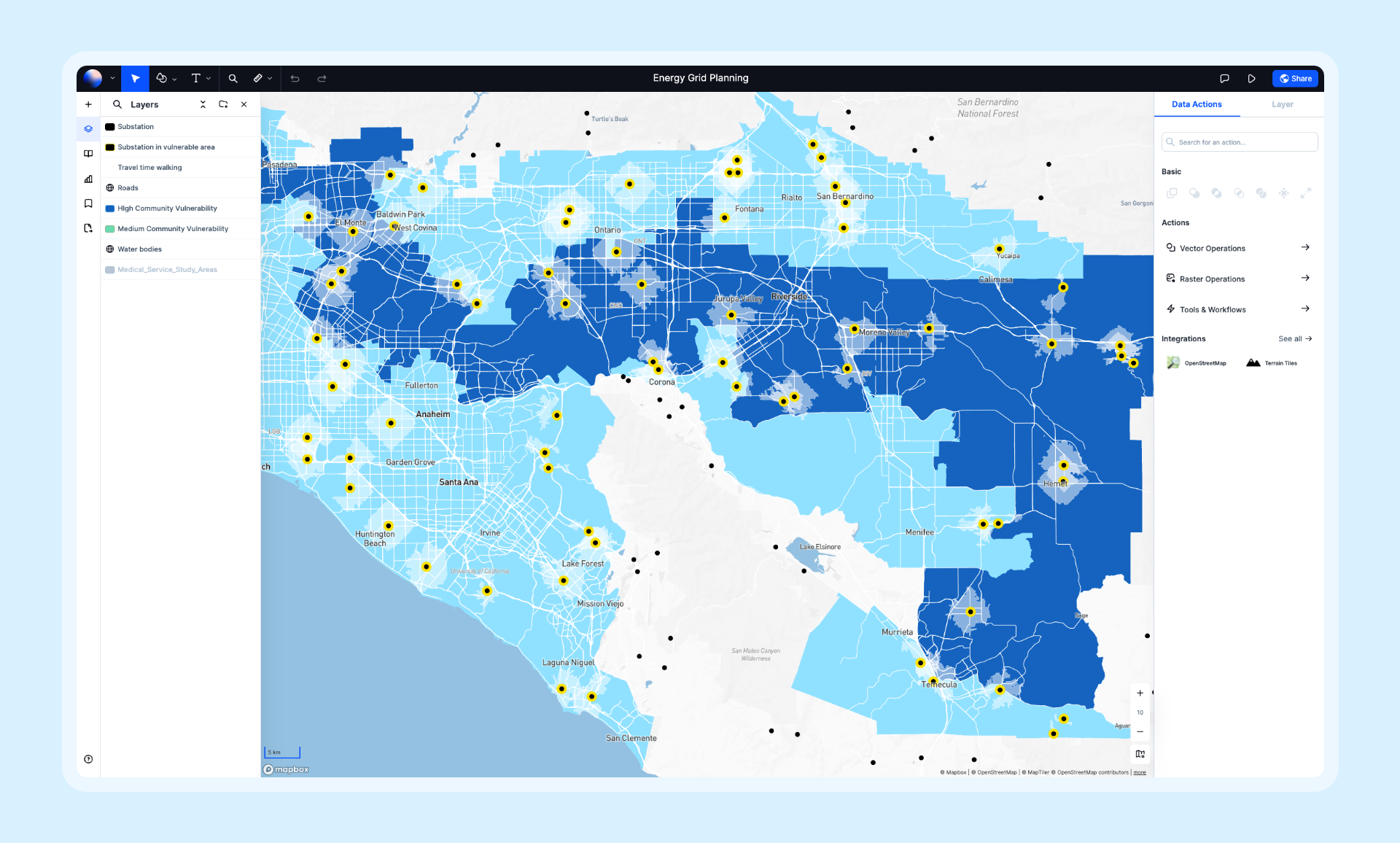
Atlas is a browser-based GIS platform designed for simplicity and efficiency.
With its drag-and-drop interface, you can upload data, create maps, and customize visuals in minutes. Atlas requires no downloads or installations, making it a hassle-free option for beginners.
Why It’s Great for Beginners:
- Intuitive and easy to navigate.
- Everything is online—no setup required.
- Offers a clean, uncluttered interface.
Atlas is perfect for creating professional-looking maps without getting bogged down by advanced GIS features.
Ready to Get Started with Atlas?
Sign up today to start creating your first map in minutes—no installation required!
2. Google My Maps
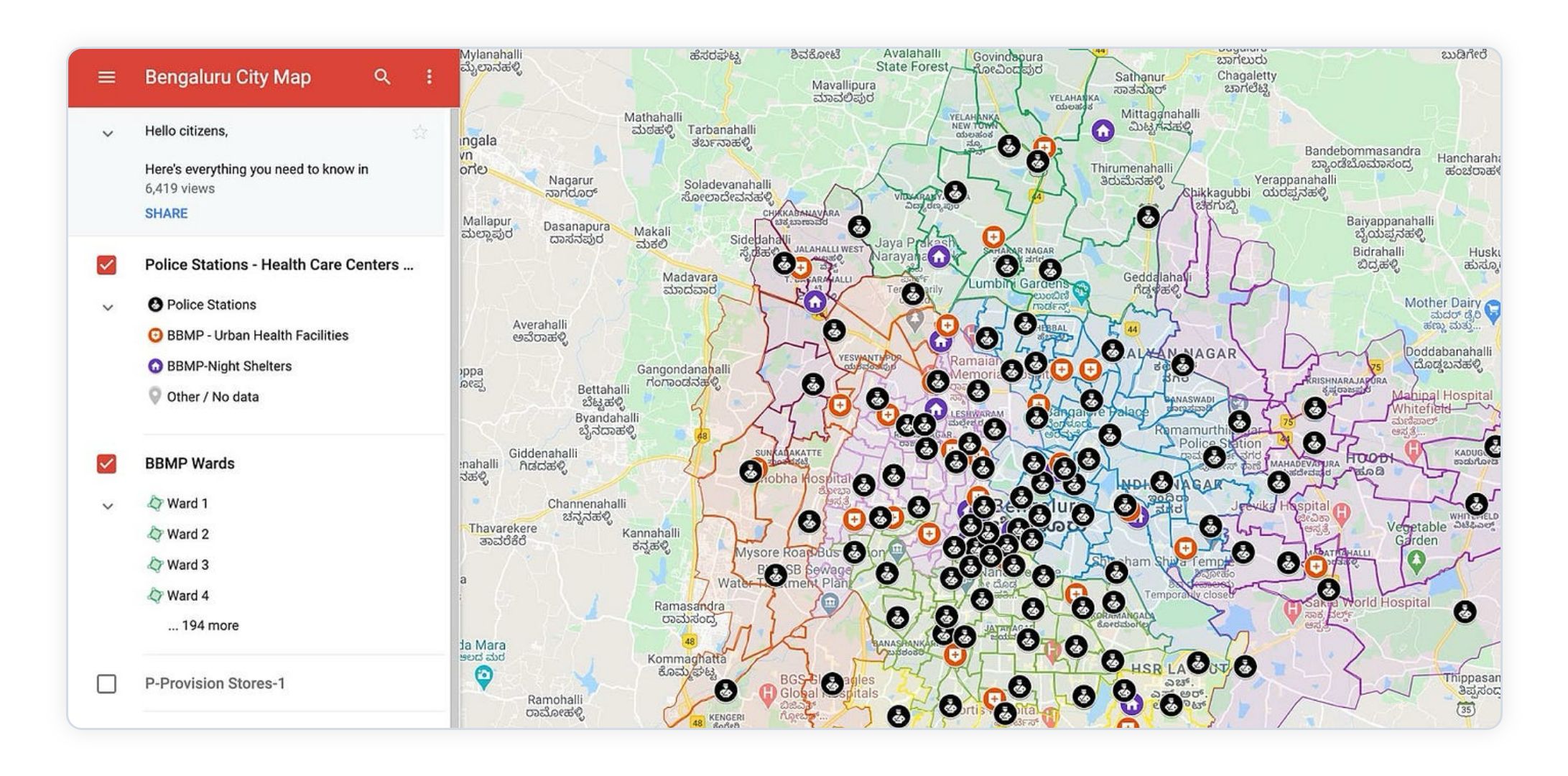
Google My Maps is a free, user-friendly tool for creating and sharing custom maps.
Built on the familiar Google Maps platform, it’s a great starting point for users who want to visualize data or map routes without dealing with complex software.
Why It’s Great for Beginners:
- Free and easy to use.
- Accessible on any device with an internet connection.
- Lets you add markers, draw shapes, and import data from spreadsheets.
Google My Maps is an excellent choice for personal projects, basic mapping tasks, and collaboration.
3. Maptive
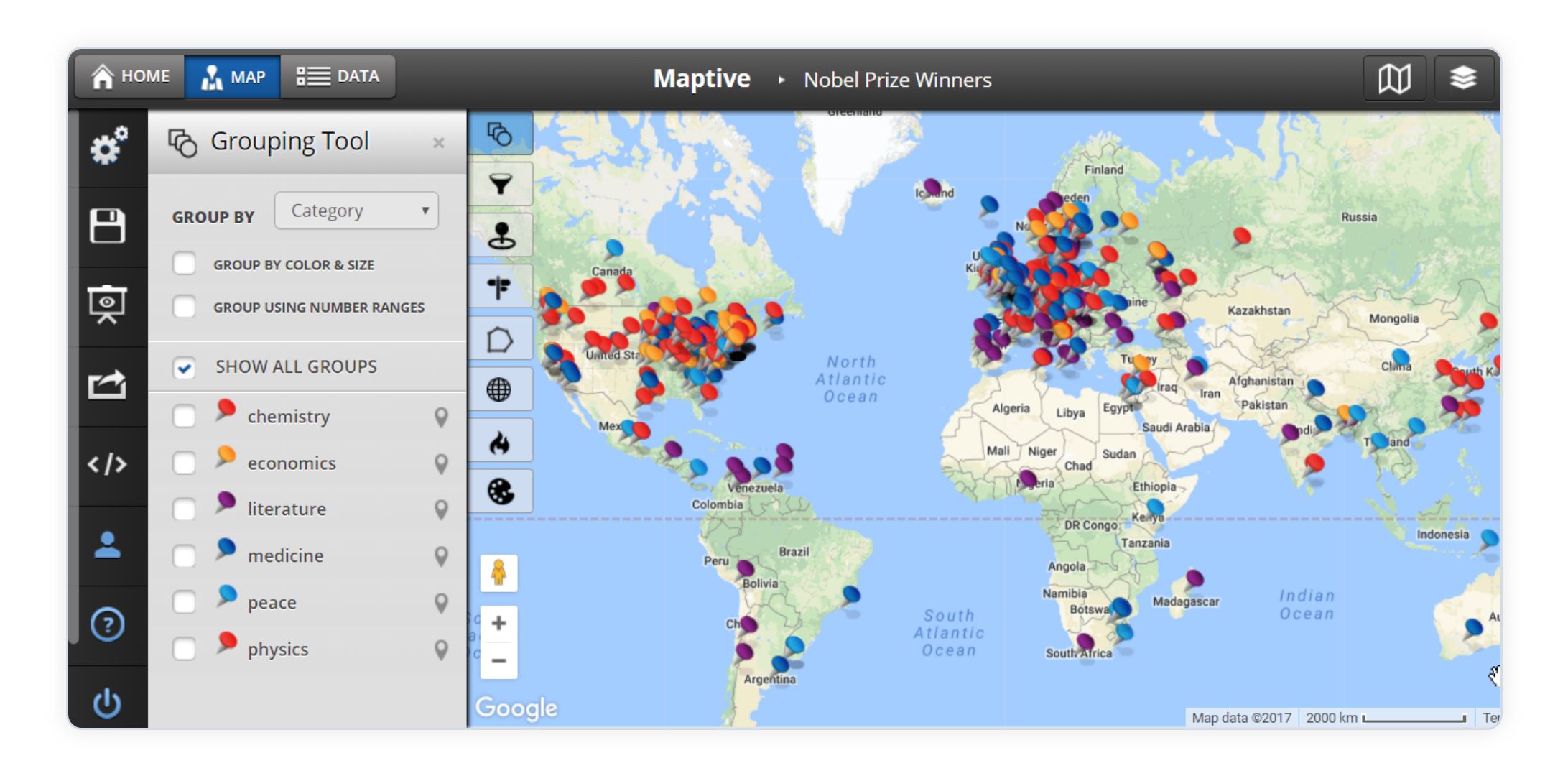
Maptive is a cloud-based mapping tool built for non-technical users.
It simplifies the process of creating data-driven maps by connecting directly to spreadsheets or databases. With customizable options and a focus on usability, it’s ideal for those new to GIS.
Why It’s Great for Beginners:
- No software installation required.
- Easy integration with Google Sheets and Excel.
- Provides clear tutorials and support for new users.
Maptive is best for businesses and individuals looking for fast, polished maps.
4. Datawrapper
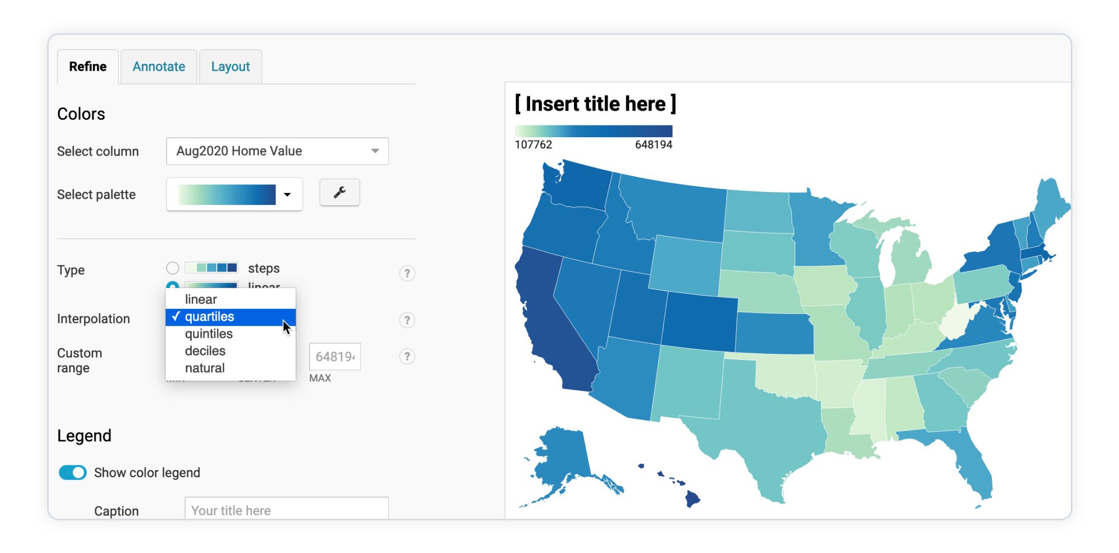
Datawrapper is an online platform for creating interactive charts and maps.
While not a full-fledged GIS tool, it’s an excellent starting point for users who want to present data visually without diving into technical mapping features.
Why It’s Great for Beginners:
- No coding or GIS knowledge needed.
- Simple drag-and-drop functionality.
- Perfect for journalists, marketers, and researchers.
Datawrapper is ideal for quickly creating maps to accompany reports or presentations.
5. Scribble Maps
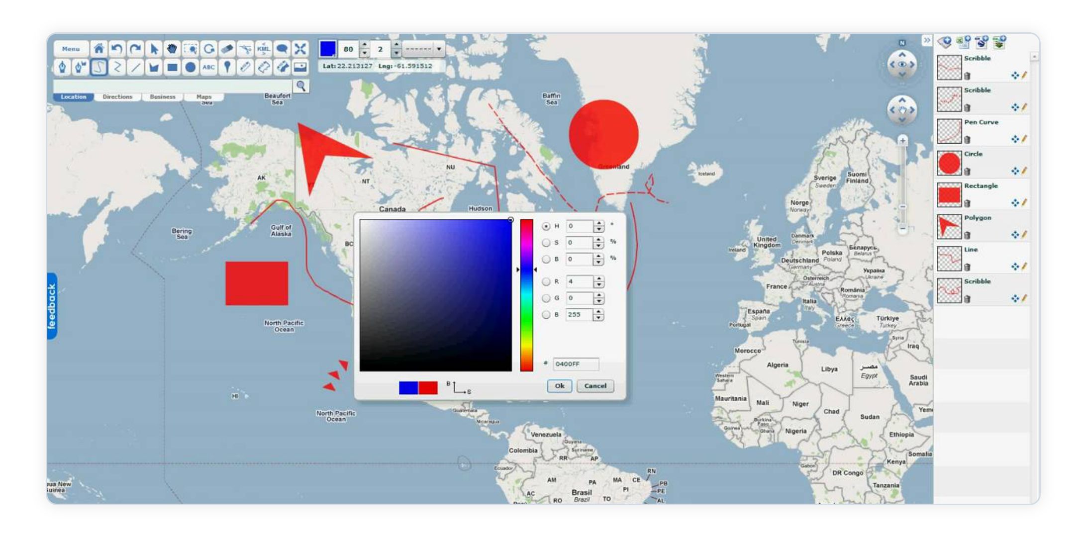
Scribble Maps is a straightforward tool for creating and annotating maps.
It’s designed for users who need basic mapping capabilities without the complexity of professional GIS software.
Why It’s Great for Beginners:
- Easy drawing tools for marking routes, points, and areas.
- Works directly in your browser.
- Free version available for small projects.
Scribble Maps is perfect for creating personal maps or planning small-scale projects.
6. ArcGIS Online (Basic Features)
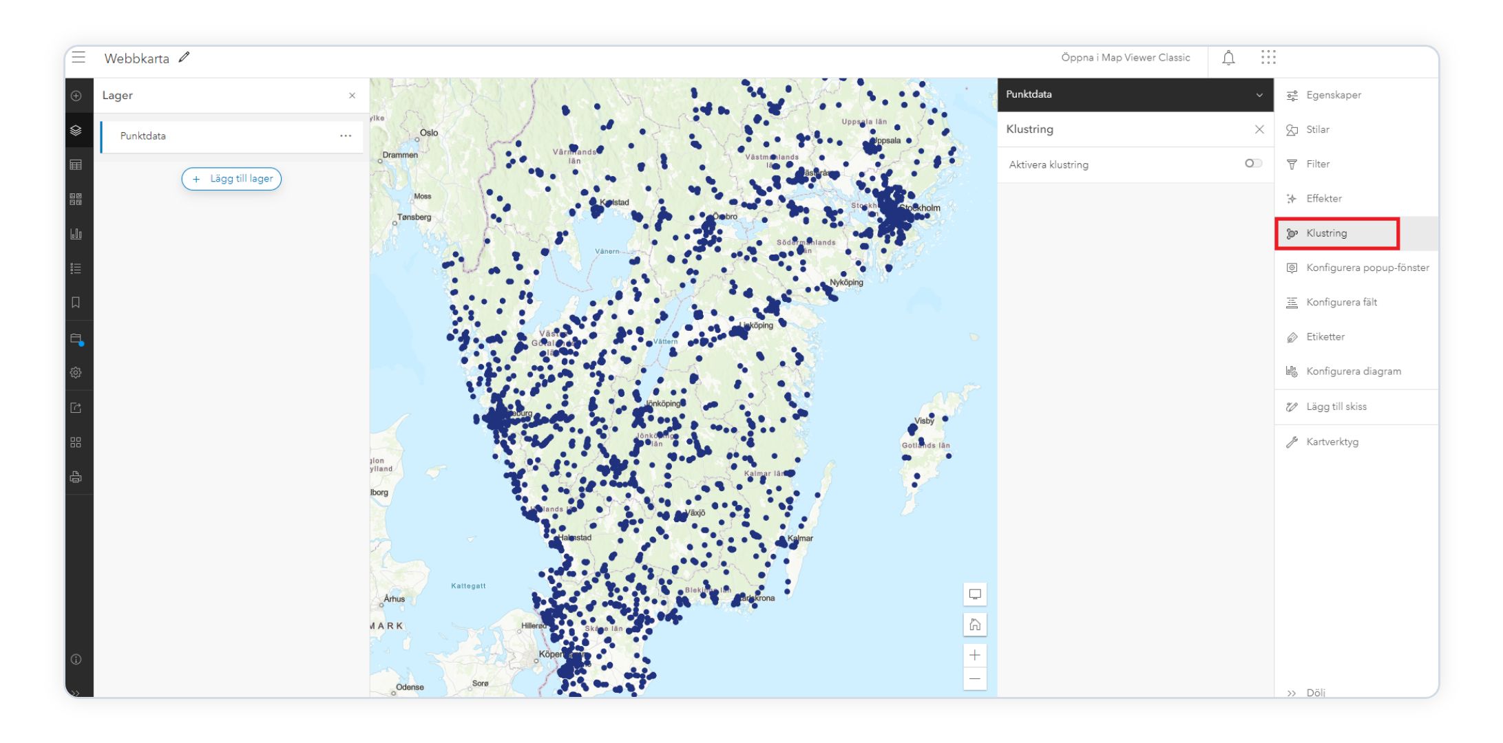
ArcGIS Online is a powerful cloud-based GIS tool from Esri, but its basic features are accessible to beginners.
While the platform offers advanced functionality, its intuitive interface and extensive learning resources make it a good entry point for new users.
Why It’s Great for Beginners:
- Includes pre-made templates for common tasks.
- Cloud-based, so no complex installation.
- Supported by a wealth of tutorials and a strong user community.
ArcGIS Online is a great choice for those planning to grow their GIS skills over time.
7. Google Earth Pro
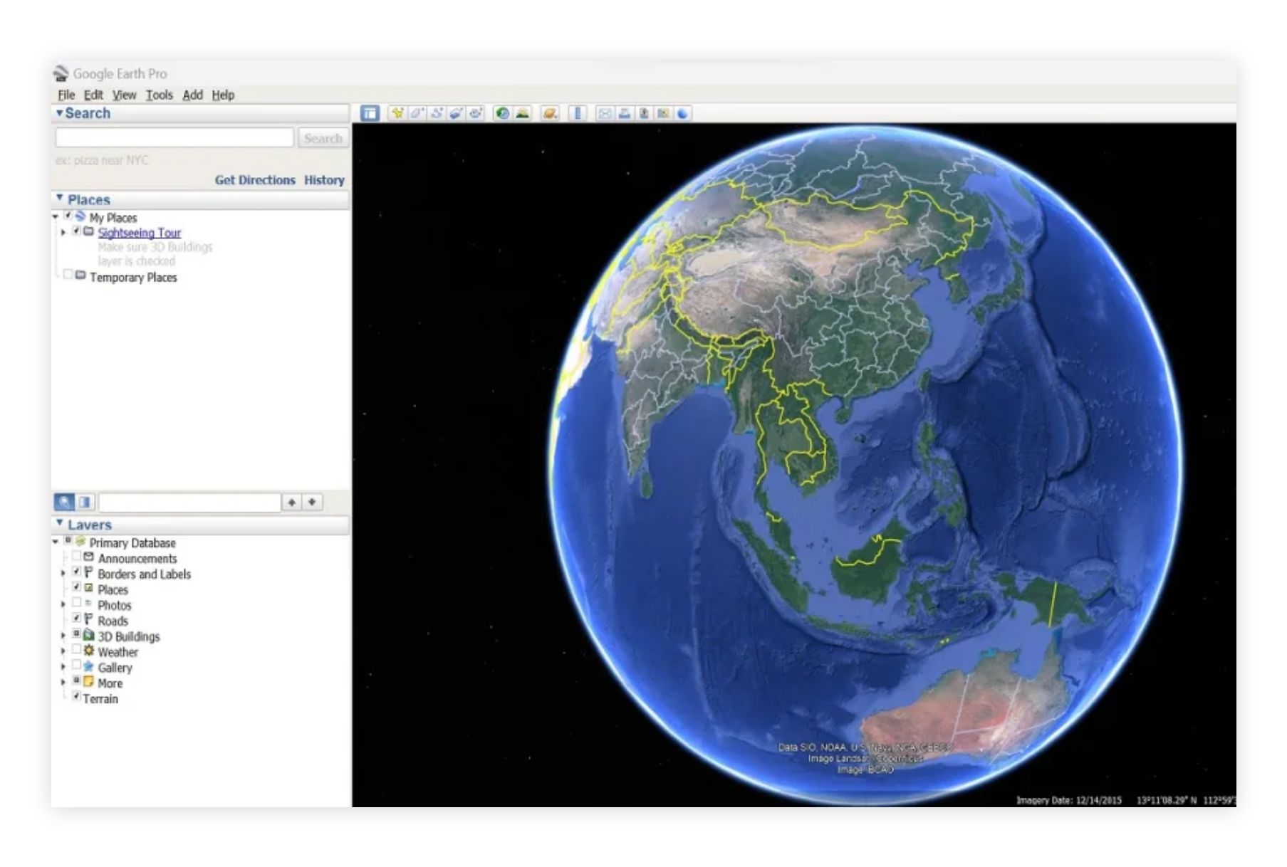
Google Earth Pro provides an immersive way to explore geographic data.
While it’s not as feature-rich as some GIS tools, it offers excellent visualization options and basic mapping capabilities in a beginner-friendly format.
Why It’s Great for Beginners:
- Free to download and use.
- 3D visualization for engaging maps.
- Simple tools for adding points, lines, and polygons.
Google Earth Pro is ideal for educators, students, and hobbyists exploring GIS for the first time.
8. QGIS (With Beginner Tutorials)
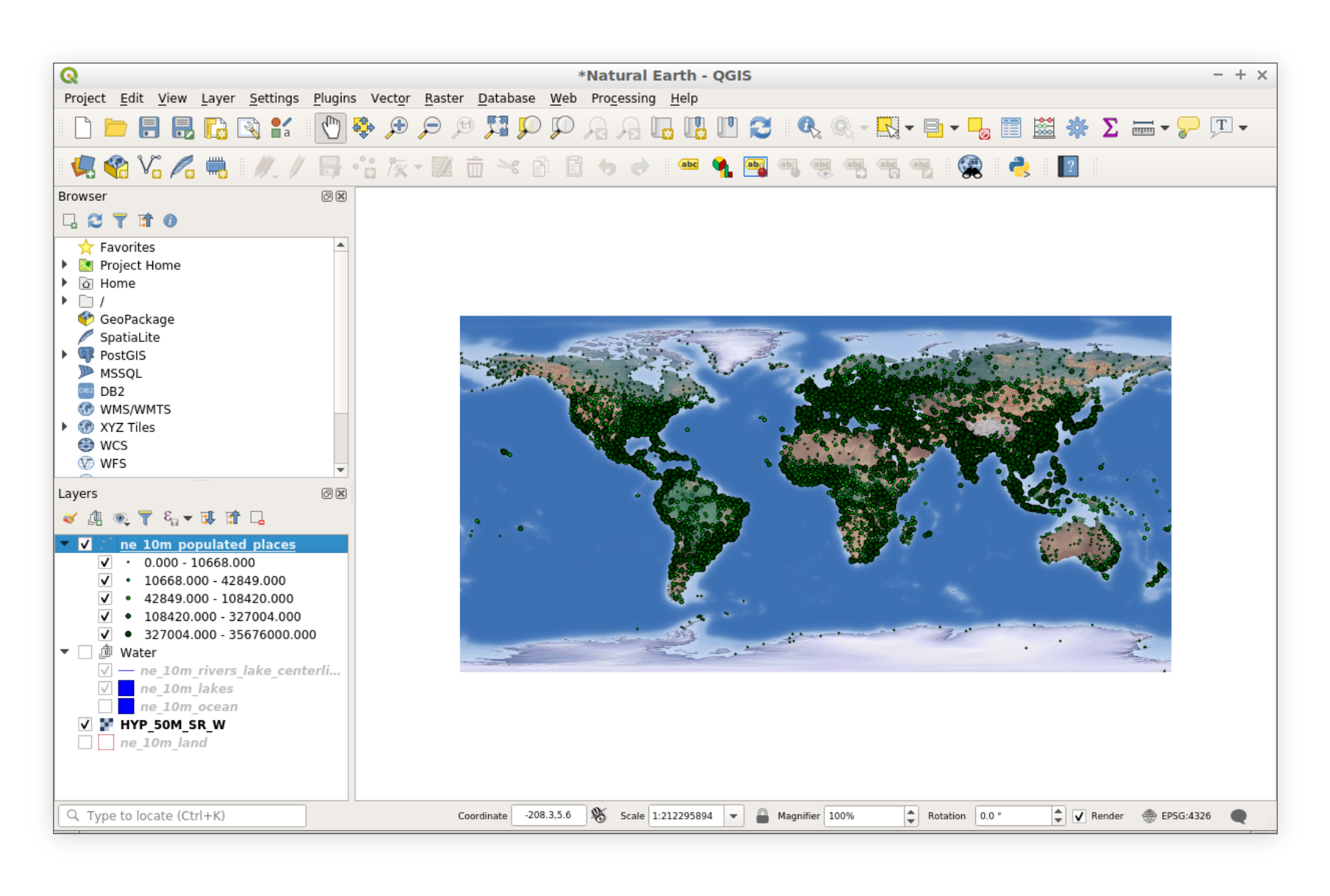
QGIS is a powerful open-source GIS tool, but its beginner-friendly tutorials make it accessible even for those new to GIS.
While the interface might seem overwhelming at first, step-by-step guides and an active community can help beginners navigate its features.
Why It’s Great for Beginners:
- Free and open-source.
- Comprehensive online tutorials for learning the basics.
- Scalable as your skills improve.
QGIS is a fantastic option for beginners who want to dive into more advanced GIS capabilities over time.
Final Thoughts
Getting started with GIS doesn’t have to be daunting.
Beginner-friendly tools like Atlas, Google My Maps, and Datawrapper are excellent starting points for creating simple, engaging maps. As your skills grow, platforms like ArcGIS Online and QGIS offer more advanced features to explore.
Start small, experiment with these tools, and discover the power of GIS.

