Learn How This Was Made
Ensuring that medical facilities are easily accessible to local residents is crucial for community well-being. With Atlas, you can use travel time catchment areas to pinpoint underserved communities and strategically plan the location of new healthcare services.
Follow these steps to enhance accessibility to healthcare:
Step 1: Data Setup
Begin by importing data on existing healthcare facilities into the platform. Find your area of interest that you want to assess in detail.

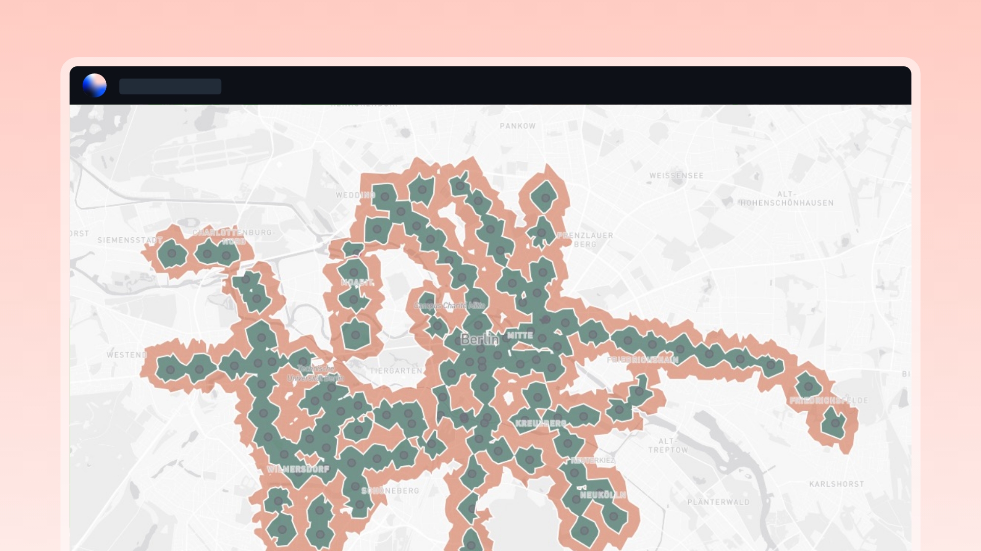
Step 2: Travel Time Analysis
Utilize Atlas’ Travel Time analysis to create catchment areas that simulates how far a resident can get in a specified time. A common guideline for travel time to a healthcare service for residents is to aim for a travel time of 30 minutes or less.

Step 3: Calculate Population Served
Quantifying the population residing in the catchment areas allows for a nuanced understanding of healthcare needs and aids in strategic resource allocation.
-
Overlay Demographic Data
Import demographic data, including population distribution
- Use Zonal Statistics to calculate the population served within each catchment area

Step 4: Identify Underserved Communities
To ensure effective healthcare access, it's vital to identify areas where communities might be underserved or face challenges in reaching medical facilities.
- Pinpoint regions with limited coverage. These areas signify blackspots where residents may face challenges in accessing healthcare services
- Overlay population density onto these regions to gauge the impact on residents


Conclusion
By employing Travel Time Analysis and geospatial analysis on Atlas, you can proactively address healthcare accessibility challenges. This guide empowers you to identify underserved communities, strategically plan new healthcare service locations, and contribute to improved healthcare access for the larger population.
Need more help?
Still have questions? We're here to help! Reach out to our support team at help@atlas.co and we'll get back to you as soon as possible.