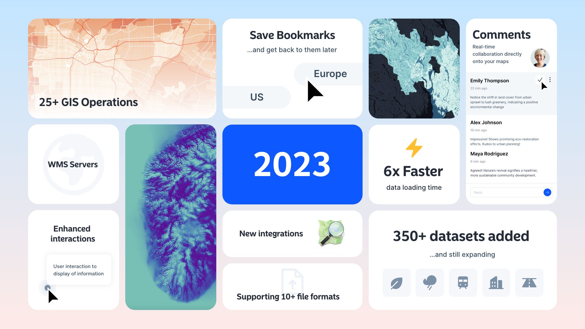
As 2023 draws to a close, we at Atlas are thrilled to share the incredible journey we've had throughout the year. It's been a period of forging exciting partnerships with our valued customers and introducing groundbreaking product updates that redefine the way you interact with geographic data.
Join us as we take a closer look at the highlights of our Year in Review and unveil the latest updates that promise to elevate your mapping experience in the coming year.
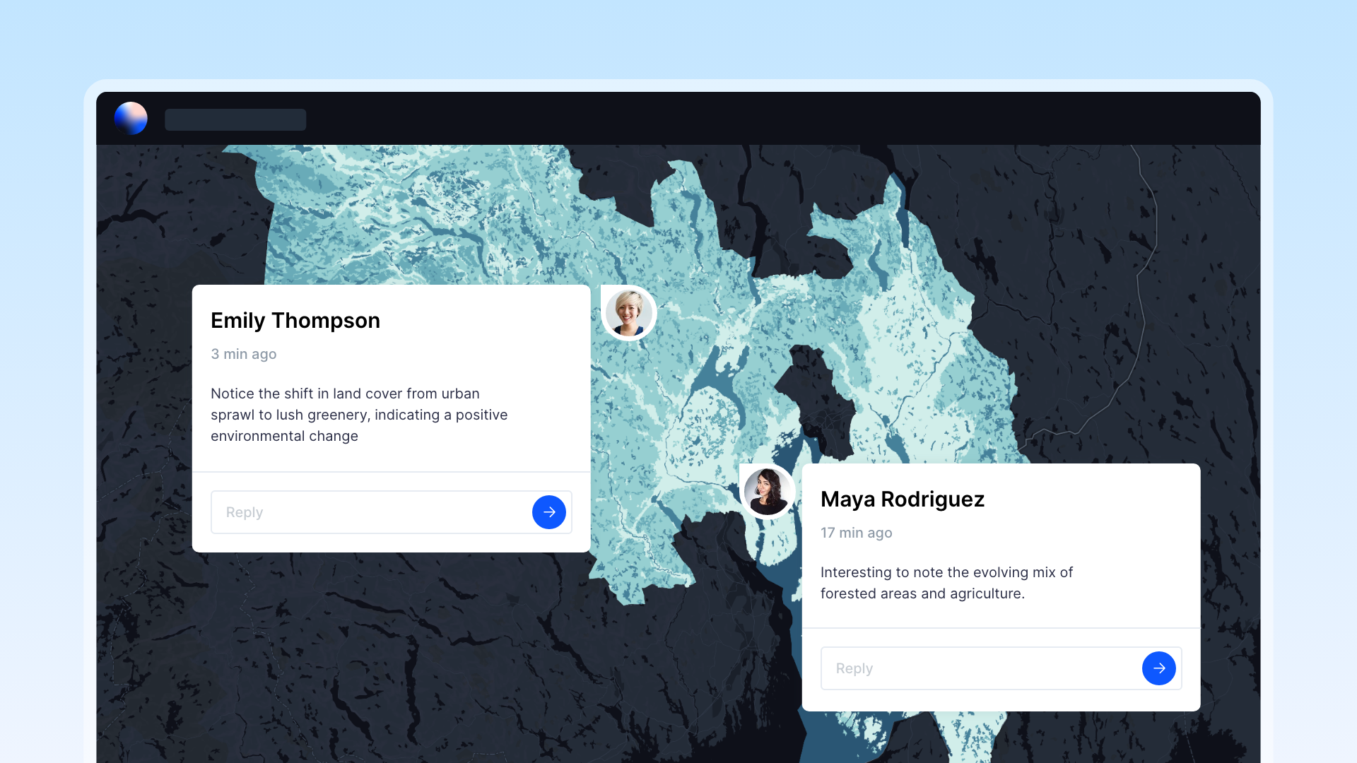
Map Comments: Fostering Real-Time Collaboration
One of the standout features introduced this year is Map Comments — a powerful tool that brings real-time collaboration directly onto your maps. Imagine engaging in dynamic discussions, sharing feedback, and exchanging insights seamlessly within the context of your mapped data. With just a few clicks, you can pinpoint a location on the map and effortlessly add your thoughts, fostering efficient communication among team members. Map Comments empower you to make data-driven decisions collaboratively, unlocking a new dimension of interactivity in your mapping endeavors.

Bookmarks: Your Shortcut to Exploration
Introducing Bookmarks — an innovative feature designed to enhance your mapping experience by allowing you to identify and save geographic locations for future reference. Bookmarks serve as shortcuts to interesting places on a map, enabling you to effortlessly navigate back to specific view extents. As a map author, you have the power to create Bookmarks based on the current location and scale of the map. When others click on a Bookmark, the map seamlessly zooms to that designated location, streamlining exploration and enhancing overall map accessibility.
Popup: Elevating User Interaction
A sleek addition to our toolkit, Popup enhances user interaction by providing a visually appealing display of information. This feature enables you to present data in an engaging format, making it more accessible and user-friendly. Popup adds a layer of sophistication to your maps, ensuring that the information you convey is not only comprehensive but also visually stimulating.
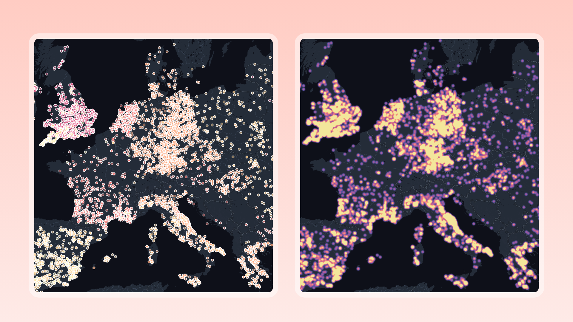
Heatmaps: Reveal Patterns
Enter the world of Heatmaps, or isorhythmic maps, a feature that transforms dense point data into a visually captivating cluster. This layer style displays gradients of concentrations, simplifying overwhelming complexity into something both understandable and beautiful. Heatmaps not only enhance the visual appeal of your maps but also provide valuable insights by highlighting patterns and trends within your data.
Rasters: Aerial Imagery
With the support of raster files, Atlas now allows you to display digital aerial photographs, satellite imagery, scanned maps, digital pictures, or surface and thematic data directly within the platform. Rasters open up a world of possibilities, enriching your maps with detailed visual information and providing a more comprehensive view of your geographic data.
5-6x Speed Boost: Ringing in the New Year with Faster Data Loading
As we approach the new year, we're excited to announce a significant speed boost to the Atlas platform. Enjoy a faster, more efficient mapping experience that allows you to navigate and analyze data with unprecedented speed. This enhancement reflects our commitment to providing you with cutting-edge technology, ensuring that your mapping endeavors are not only productive but also enjoyable.

350+ Datasets Added to Atlas Data Hub
In our relentless pursuit of making geospatial analysis easier, we've expanded the Atlas Data Hub with the addition of over 350 datasets. This hub of data spans various domains, providing you with an extensive collection of data to enhance your mapping projects. Our commitment to continually enriching the data available to you is unwavering, ensuring that you have the resources you need for successful mapping endeavors.

Supports 10+ File Formats
Atlas now boasts support for over 10 file formats, offering unparalleled flexibility in handling geospatial data. From GeoJSON and KML to Geodatabase and Spreadsheets, Atlas reads the most common geospatial data formats, ensuring that you can seamlessly integrate diverse datasets into your maps. This broad compatibility empowers you to explore and analyze data from various sources, making Atlas a versatile platform for all your mapping needs.

25+ GIS Operations: Unleashing the Power of Analysis
Our commitment to empowering users with advanced analytical capabilities is evident in the addition of over 25 GIS operations to the Atlas toolkit. Whether you're conducting spatial analysis, data manipulation, or modeling, these operations provide you with a comprehensive set of tools to unlock the full potential of your geographic data.
Connect to External WMS Server
Atlas now allows you to connect seamlessly to external WMS (Web Map Service) servers, bridging the gap between different geographic data sources. This integration enhances your ability to access a wide range of data, opening up new possibilities for collaboration and data enrichment.
Wrapping up
As we wrap up a remarkable year at Atlas, we extend our heartfelt gratitude to our community for their unwavering support. The journey of 2023 has been marked by growth, innovation, and a steadfast commitment to providing you with the best possible mapping experience. From the introduction of Map Comments and Bookmarks to the visual elegance of Popup and Heatmaps, our aim has been to elevate your mapping endeavors to new heights.
As we usher in the new year, we're thrilled to announce a 5-6x speed boost, ensuring that your mapping experience remains both efficient and enjoyable. With an expanded Atlas Data Hub, support for 10+ file formats, and over 25 GIS operations, we're equipping you with the tools and resources needed for success in your geospatial endeavors.
From all of us at Atlas, we wish you a joyous holiday season and a prosperous new year. Here's to more exciting mapping adventures in 2024!


